Sunday 20 September 2020

EVOLUTION OF FISH

The evolution of fish began about 530 million years ago with the first fish lineages belonged to the Agnatha, a superclass of jawless fish.

We still see them in our waters as cyclostomes but have lost the conodonts and ostracoderms to the annals of time. 

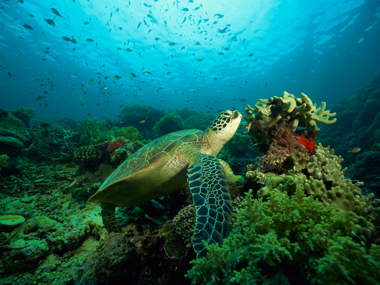
Like all vertebrates, fish have bilateral symmetry; when divided down the middle or central axis, each half is the same. Organisms with bilateral symmetry are generally more agile, making finding a mate, hunting or avoiding being hunted a whole lot easier. While we still find them on our menus, the ability to move quickly means they avoid being the snack of choice, an honour that falls more to the invertebrates with whom they share the sea.

When we envision fish, we generally picture large eyes, gills, a well-developed mouth. The earliest animals that we classify as fish appeared as soft-bodied chordates who lacked a true spine. While they were spineless, they did have notochords, a cartilaginous skeletal rod that gave them more dexterity than the cold-blooded invertebrates who shared those ancient seas and evolved without a backbone.

Fish would continue to evolve throughout the Paleozoic, diversifying into a wide range of forms. Several forms of Paleozoic fish developed external armour that protected them from predators. The first fish with jaws appeared in the Silurian period, after which many species, including sharks, became formidable marine predators rather than just the prey of arthropods.

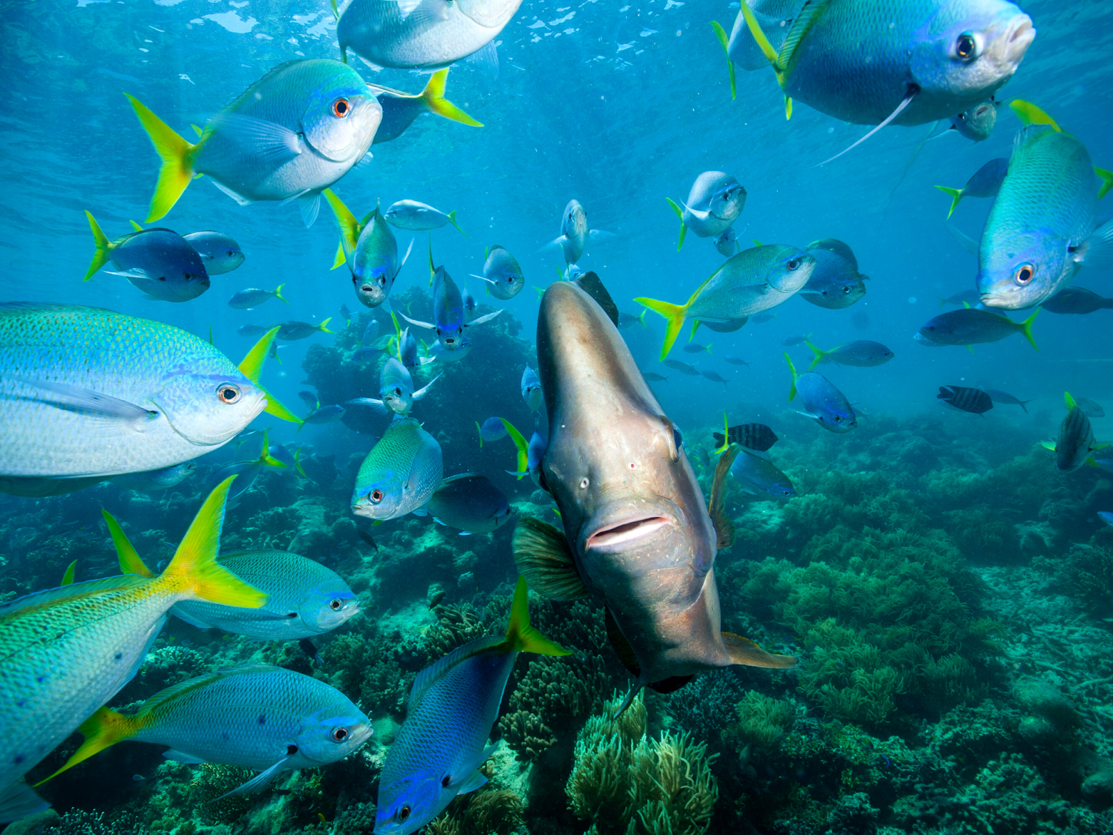
Fishes in general respire using gills, are most often covered with bony scales and propel themselves using fins. There are two main types of fins, median fins and paired fins. The median fins include the caudal fin or tail fin, the dorsal fin, and the anal fin. Now there may be more than one dorsal, and one anal fin in some fishes.

The paired fins include the pectoral fins and the pelvic fins. And these paired fins are connected to, and supported by, pectoral and pelvic girdles, at the shoulder and hip; in the same way, our arms and legs are connected to and supported by, pectoral and pelvic girdles. This arrangement is something we inherited from the ancestors we share with fishes. They are homologous structures.

When we speak of early vertebrates, we're often talking about fishes. Fish is a term we use a lot in our everyday lives but taxonomically it is not all that useful. When we say, 'fish' we generally mean an ectothermic, aquatic vertebrate with gills and fins.

Rhacolepis Buccalis, an extinct genus of ray-finned fossil fish
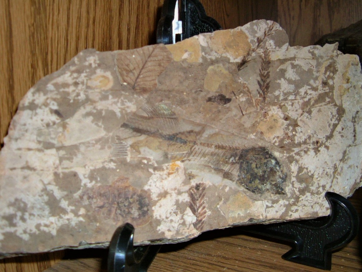
Fortunately, many of our fishy friends have ended up in the fossil record. We may see some of the soft bits from time to time, as in the lovely Rhacolepis Buccalis, an extinct genus of ray-finned fossil fish in carbonate concretion from the Lower Cretaceous, Santana Formation, Brazil.

Not surprisingly, vertebrates with hard skeletons have a much better chance of being preserved than those with just soft parts and no teeth or bone to speak of.

In British Columbia, we have lovely two-dimensional Eohiodon rosei, a common freshwater fossil fish well-represented in Eocene deposits from the Allenby of Princeton and McAbee Fossil Beds near Cache Creek. We also have the Tiktaalik roseae, a large freshwater fish, from 375 million-year-old Devonian deposits on Ellesmere Island in Canada's Arctic. Tiktaalik is a wonderfully bizarre creature with a flat, almost reptilian head but also fins, scales and gills. We have other wonders from this time. There are also spectacular antiarch placoderms, Bothriolepsis, found in the Upper Devonian shales of Miguasha in Quebec.

There are fragments of bone-like tissues from as early as the Late Cambrian with the oldest fossils that are truly recognizable as fishes come from the Middle Ordovician from North America, South America and Australia. At the time, South America and Australia were part of a supercontinent called Gondwana. North America was part of another supercontinent called Laurentia and the two were separated by deep oceans.

Eohiodon rosei, McAbee Fossil Beds
These two supercontinents and others that were also present were partially covered by shallow equatorial seas and the continents themselves were barren and rocky. Land plants didn't evolve until later in the Silurian Period.

In these shallow equatorial seas, a large diverse and widespread group of armoured, jawless fishes evolved: the Pteraspidomorphi. The first of our three groups of ostracoderms. The Pteraspidomorphi are divided into three major groups: the Astraspida, Arandaspida and the Heterostraci.

The oldest and most primitive pteraspidomorphs were the Astraspida and the Arandaspida. You'll notice that all three of these taxon names contain 'aspid', which means shield. This is because these early fishes and many of the Pteraspidomorphi possessed large plates of dermal bone at the anterior end of their bodies. This dermal armour was very common in early vertebrates, but it was lost in their descendants.

Arandaspida is represented by two well-known genera: Sacabampaspis, from South America and Arandaspis from Australia. Arandaspis have large, simple, dorsal and ventral head shields. Their bodies were fusiform, which means they were shaped sort of like a spindle, fat in the middle and tapering at both ends. Picture a sausage that is a bit wider near the centre with a crisp outer shell.

Thursday 17 September 2020

DIPLOGRAPTUS


IDENTIFYING FOSSIL BONE

If you’re wondering if you have Fossil Bone, you’ll want to look for the telltale texture on the surface. It’s best to take the specimen outside & photograph it in natural light.

With fossil bone, you will be able to see the different canals and webbed structure of the bone, sure signs that the object was of biological origin.

As my good friend Mike Boyd notes, without going into the distinction between dermal bone and endochondral bone — which relates to how they form - or ossify — it's worth noting that bones such as the one illustrated here will usually have a layer of smooth (or periosteal) bone on the outer surface and spongy (or trabecular) bone inside.

The distinction can be seen in this photograph. The partial weathering away of the smooth external bone has resulted in the exposure of the spongy bone interiors. Geographic context is important, so knowing where it was found is very helpful for an ID. 

Knowing the geologic context of your find can help you to figure out if you've perhaps found a terrestrial or marine fossil. Did you find any other fossils nearby? Can you see pieces of fossil shells or remnants of fossil leaves? Things get tricky with erratics. That's when something has deposited a rock or fossil far from the place it originated. We see this with glaciers. The ice can act like a plough, lifting up and pushing a rock to a new location, then melting away to leave something out of context.

Sunday 13 September 2020

TRENT RIVER PALAEONTOLOGY

Trent River, Vancouver Island, BC
The rocks that make up the Trent River on Vancouver Island were laid down south of the equator as small, tropical islands. They rode across the Pacific heading north and slightly east over the past 85 million years to where we find them today.

The Pacific Plate is an oceanic tectonic plate that lies beneath the Pacific Ocean. And it is massive. At 103 million km2 (40 million sq mi), it is the largest tectonic plate and continues to grow fed by volcanic eruptions that piggyback onto its trailing edge.

This relentless expansion pushes the Pacific Plate into the North American Plate. The pressure subducts it beneath our continent where it then melts back into the earth. Plate tectonics are slow but powerful forces. 

The island chains that rode the plates across the Pacific smashed into our coastline and slowly built the province of British Columbia. And because each of those islands had a different origin, they create pockets of interesting and diverse geology.

It is these islands that make up the Insular Belt — a physio-geological region on the northwestern North American coast. It consists of three major island groups — and many smaller islands — that stretches from southern British Columbia up into Alaska and the Yukon. These bits of islands on the move arrived from the Late Cretaceous through the Eocene — and continues to this day.

The rocks that form the Insular Superterrane are allochthonous, meaning they are not related to the rest of the North American continent. The rocks we walk over along the Trent River are distinct from those we find throughout the rest of Vancouver Island, Haida Gwaii, the rest of the province of British Columbia and completely foreign to those we find next door in Alberta.

To discover what we do find on the Trent takes only a wee stroll, a bit of digging and time to put all the pieces of the puzzle together. The first geological forays to Vancouver Island were to look for coal deposits, the profitable remains of ancient forests that could be burned to power industry.

Jim Monger and Charlie Ross of the Geological Survey of Canada both worked to further our knowledge of the complex geology of the Comox Basin. They were at the cutting edge of west coast geology in the 1970s. It was their work that helped tease out how and where the rocks we see along the Trent today were formed and made their way north.

We know from their work that by 85 million years ago, the Insular Superterrane had made its way to what is now British Columbia. The lands were forested much as they are now but by extinct genera and families. The fossil remains of trees similar to oak, poplar, maple and ash can be found along the Trent and Vancouver Island. We also see the lovely remains of flowering plants such as Cupanities crenularis, figs and breadfruit.

Heading up the river, you come to a delineation zone that clearly marks the contact between the dark grey marine shales and mudstones of the Haslam Formation where they meet the sandstones of the Comox Formation. Fossilized material is less abundant in the Comox sandstones but still contains some interesting specimens. Here you begin to see fossilized wood and identifiable fossil plant material.

Further upstream, there is a small tributary, Idle Creek, where you can find more of this terrestrial material in the sandy shales. As you walk up, you see identifiable fossil plants beneath your feet and jungle-like, overgrown moss-covered, snarly trees all around you.

Polyptychoceras vancouverense / BCPA 2003
Walking west from the Trent River Falls at the bottom, you pass the infamous Ammonite Alley, where you can find Mesopuzosia sp. and Kitchinites sp. of the Upper Cretaceous (Santonian), Haslam Formation. Minding the slippery green algae covering some of the river rocks, you can see the first of the Polytychoceras vancouverense zone.

Continuing west, you reach the first of two fossil turtle sites on the river — amazingly, one terrestrial and one marine. If you continue, you come to the Inland Island Highway.

The Trent River has yielded some very interesting marine specimens, and significant terrestrial finds. We've found both a wonderful terrestrial helochelydrid turtle, Naomichelys speciosa, and the caudal vertebrae of a Hadrosauroid dinosaur. Walking down from the Hadrosaur site you come to the site of the fossil ratfish find — one of the ocean's oddest fish.

Ratfish, Hydrolagus Collie, are chimaera found in the north-eastern Pacific Ocean today. The fossil specimen from the Trent would be considered large by modern standards as it is a bruiser in comparison to his modern counterparts. This robust fellow had exceptionally-large eyes and sex organs that dangled enticingly between them. You mock, but there are many ratfish who would differ. While inherently sexy by ratfish standards, this fellow was not particularly tasty to their ancient marine brethren (or humans today) — so not hugely sought after as a food source or prey.

A little further again from the ratfish site we reach the contact of the two Formations. The rocks here have travelled a long way to their current location. With them, we peel away the layers of the geologic history of both the Comox Valley and the province of British Columbia.

Photo One: Trent River, Haslam Formation, Fossil Huntress. Photo Two: Polyptychoceras vancouverense from the Upper Cretaceous (Santonian), Haslam formation, Trent River, Vancouver Island, British Columbia, Canada. 2003 BCPA Calendar.

References: Note on the occurrence of the marine turtle Desmatochelys (Reptilia: Chelonioidea) from the Upper Cretaceous of Vancouver Island Elizabeth L. Nicholls Canadian Journal of Earth Sciences (1992) 29 (2): 377–380. https://doi.org/10.1139/e92-033; References: Chimaeras - The Neglected Chondrichthyans". Elasmo-research.org. Retrieved 2017-07-01.

Directions: If you're keen to explore the area, park on the side of Highway 19 about three kilometres south of Courtenay and hike up to the Trent River. Begin to look for parking about three kilometres south of the Cumberland Interchange. There is a trail that leads from the highway down beneath the bridge which will bring you to the Trent River's north side.


Saturday 12 September 2020

UNEARTHING A JUVENILE ELASMOSAUR ON THE TRENT RIVER

Pat Trask with a Fossil Rib Bone. Photo: Rebecca Miller
A mighty marine reptile was excavated on the Trent River near Courtenay on the east coast of Vancouver Island, British Columbia, Canada in August 2020.

The excavation is the culmination of a three-year palaeontological puzzle.

The fossil remains are those of an elasmosaur — a group of long-necked marine reptiles found in the Late Triassic to the Late Cretaceous some 215 to 80 million years ago. 

In the case of the Trent River, it is closer to 85 million years old. The rocks that make up this riverbed today were laid down south of the equator as small, tropical islands. They rode slow-moving tectonic plates across the Pacific — heading north and slightly east over the past 85 million years to where we find them today.

The marine reptile fossil was excavated 10-meters up high on the cliffs that line the river. It took a month of careful planning, building scaffolding, and amassing climbing gear to aid the team of dedicated souls in unearthing this juvenile elasmosaur. 

Bits and pieces of him have been eroding out for years — providing clues to the past and a jigsaw puzzle that has finally had the last pieces put together. The first piece of this marine reptile puzzle was found three years ago. 

The Courtenay Museum hosts regular fossil tours here, led by Pat Trask. On one of those field trips back in 2017, Pat was leading a trip with a family and one of the field trip participants picked up a marine reptile finger bone. It was laying in the river having eroded out from a nearby cliff. She showed it to Pat and he immediately recognized it as being diagnostic — it definitely belonged to a marine reptile — possibly an elasmosaur — but what species and just where on the river it had eroded from were still a mystery. She kindly donated it to the museum and that was that.

While it was an exciting find, it was a find without origin. Just where the material was coming from was unknown. It could have eroded from anywhere upstream and while many had searched the river, no other bone bits were found.   

Pat Trask Wrapping the plaster casing
Then in 2018, another piece of this paleontological puzzle was revealed. Pat was leading yet another Courtenay Museum Fossil Tour on the Trent River when one of the participants showed him a specimen that looked like a really tiny hockey puck. This second find was a wrist bone — again possibly from an elasmosaur but hard to be sure. Contemplating out loud where this material could be coming from, Pat looked down and found a vertebra in the water below his feet.

Pat put the bones in the lab at the museum. Intrigued by their origin, he began heading down to the river on his off hours to see where they might be coming from and thinking about where the erosion occurs on the Trent. 

In 2019, "I came down here and I started thinking about where the water flow would go." He could see a ledge along the river where eroded material might gather. Once he checked, he found a crack and cleaned out all the rock gathered there, finding more than a dozen bones. Pat teamed up with members of the Vancouver Island Palaeontological Society (VIPS) to scale the cliff faces above that section of the river. Jason Hawley, VIPS, did some rappelling but missed the site by a matter of feet.  

Pat had his neighbour fly a drone along the cliff face but it, too, turned up with nothing. Then at the beginning of August, Pat was back on the river in the morning with a family and said to one of the kids, "Hey, let's go look for baby elasmosaur." then they walked right over and saw a neckbone or tailbone in the river. Pat knew it hadn't been there the day before. He looked up and thought it must be coming from right up here. He came back later in the day with Deb Griffiths, his wife, set up his telescope on the river aimed at the likely portion of the cliff and bingo — he could see a bone sticking out.

He returned the next day with his brother Mike Trask. Mike found the elasmosaur on the Puntledge River back in 1988.  "We took a long pole and I said here's my target — and I hit one little piece, maybe three inches by three inches. When it fell down it had bones in it." Excited, they began planning a larger excavation that would include scaffolding, safety planning, climbing gear, permits... a lot of work in a short time. 

Plesiosaur Gastrolith
Initially, they thought there would be a small amount of fossil material, perhaps a few finger bones but over the past few weeks, they have found bones of at least half a marine reptile. 

And the beauty of this find is that most of the bones do not have to be prepared. They are literally eroding out of the matrix. No prep means no tools. Tools can impact the shape of a bone as you prepare it. They've found the pelvis bones, humerus, radius — all diagnostic to identify the genus. And this may be a new species. If it is, there is a good chance it will be named after the Trask family. 

I caught up with Pat and the team from the VIPS out on the river on August 23, 2020 — the day of the excavation. Loose rib bones, gastroliths, wrist bones, finger bones and part of the back and pelvis were recovered — and possibly the head, too. 

The bulk of the specimen was wrapped in plaster and carefully lowered to the ground by Pat and members of the VIPS, under Mike Trask's careful eye. We know that there is a femur in that jacket and possibly all the bones associated with that. Also included are the fibula and tibia and their associated bones — and I'm truly hoping there is a skull in there, too! I've popped a link below of a wee video showing the final moments as the plaster cast is lowered down from the excavation site. Take a look! It was quite an exciting moment.

It is not quite a baby, but this diminutive fellow is about four-metres long, making it a juvenile of his species. We have prepped enough of the material now to safely call it an elasmosaur. James Wood of the VIPS has done an amazing job on the preparation of this specimen using a new smaller air abrasive purchased by the Courtenay Museum. 

I hope to see it published with the Trask family name. Their paleontological history is forever tied to the Comox Valley and the honour would be fitting.  

Photo One: Rebecca Miller, Little Prints Photography — she is awesome!

Photo Two: James Wood prepped the material and Pat Trask labelled and oriented the bones.

Photo Three: Pat Trask perched atop scaffolding along the Trent River. And yes, he's attached to a safety line to secure him in case of fall. 

Photo Four: A gastrolith recovered amongst the stomach contents of the Trent River excavation. A gastrolith is a rock held inside a gastrointestinal tract. Gastroliths in some species are retained in the muscular gizzard and used to grind food in animals lacking suitable grinding teeth. The grain size depends upon the size of the animal and the gastrolith's role in digestion. Other species, including marine reptiles, use gastroliths as ballast — which may have been the case here. 

See the Excavation Moment via Video Link: https://youtu.be/r82EcEF7Pfc

Friday 11 September 2020

UPPER CRETACEOUS FAUNA OF THE PACIFIC

Mosasaur from Manitoba, Courtenay Museum Collection
The Pacific fauna from the Upper Haslam Formation was cut-off geographically from their contemporaries living in the waters of the Western Interior Seaway.

That Seaway — also called the Cretaceous Seaway, the Niobrara Sea, the North American Inland Sea, and the Western Interior Sea  — was the large inland sea that formed during the mid- to late Cretaceous and again during the very early Paleogene. 

It split the continent of North America into two landmasses, Laramidia to the west and Appalachia to the east. We see evidence of this isolation when we look at the fossil marine reptiles from the Late Cretaceous Nanaimo Group of Vancouver Island. The Late Cretaceous Western Interior Seaway of North America has an abundant and well-studied record of fossil marine reptiles. The Pacific faunas we find on Vancouver Island were isolated from their contemporaneous faunas in the Western Interior Seaway. The ancient sea stretched from the Gulf of Mexico and through the middle of the modern-day countries of the United States and Canada, meeting with the Arctic Ocean to the north. At its largest, it was 2,500 feet (760 m) deep, 600 miles (970 km) wide and over 2,000 miles (3,200 km) long.

Betsy Nicholls and Dirk Meckert published on the marine reptiles from the Nanaimo Group (Upper Cretaceous) of Vancouver Island in the Canadian Journal of Earth Sciences in 2002.

They were comparing the newly discovered fossil from the Haslam and Pender formations (upper Santonian) near Courtenay, British Columbia, which include elasmosaurid plesiosaurs, turtles, and mosasaurs. These finds are only the second fauna of Late Cretaceous marine reptiles known from the Pacific Coast, the other being the fossiliferous shales from the Chico Group, Moreno Formation of California (Maastrichtian) that overlies the Panoche Formation.

The Nanaimo Group fossils are some 15 million years older than those from the Moreno Formation. Similarly to the California fauna, there are no polycotylid plesiosaurs — though the Nanaimo Group fauna does include a new genus of mosasaur. The species that we find on Vancouver Island lived at the same time but were not mixing geographically. What we see in our faunal mix reinforces the provinciality of the Pacific faunas and their isolation from contemporaneous faunas in the Western Interior Seaway.

Elizabeth L Nicholls and Dirk Meckert; Marine reptiles from the Nanaimo Group (Upper Cretaceous) of Vancouver Island; Canadian Journal of Earth Sciences, 2002, 39(11): 1591-1603, https://doi.org/10.1139/e02-075

Thursday 10 September 2020

TURTLE SHELLS AND DERMAL PLATES

Turtle shells are different from the body armour or armoured shells we see adorning dinosaurs like the ankylosaurs. These bad boys were blessed with huge plates of bone embedded into their skin that acted as a natural shield against predators. 

We find similar body armour is found on a crocodile or armadillo.

Turtles are covered by a special bony or cartilaginous shell that originates in their ribs. It is a useful adaptation to help deter predators as their soft interior makes for a tasty snack. 

Though I've never eaten turtle, it was a common and sought after meat for turtle soup. I'd read of Charles Darwin craving it after trying it for the first time on his trip in 1831 aboard the HMS Beagle. It seems Charlie like to taste every exotic new species he had the opportunity to try.

Turtle armour is made of dermal bone and endochondral bones from their vertebrae and rib cage. It is fundamentally different from the armour seen on our other vertebrate friends and the design creates some unique features in turtles. Because turtle ribs fuse together with some of their vertebrae, they have to pump air in and out of the lungs with their leg muscles. 

Another unusual feature in turtles is their limb girdles (pectoral and pelvic) have come to lie 'within' their rib cage, a feature that allows some turtles to pull their limbs inside the shell for protection. Sea turtles didn't develop this behaviour (or ability) and do not retract into their shells like other turtles.

Armadillos have armour formed by plates of dermal bone covered in relatively small, overlapping epidermal scales called scutes, composed of bone with a covering of horn. In crocodiles, their exoskeletons form their armour, similar to ankylosaurs. A bit of genius design, really. It is made of protective dermal and epidermal components that begin as rete Malpighii: a single layer of short, cylindrical cells that lose their nuclei over time as they transform into a horny layer.

Depending on the species and age of the turtle, turtles eat all kinds of food including seagrass, seaweed, crabs, jellyfish, and shrimp,. That tasty diet shows up in the composition of their armour as they have oodles of great nutrients to work with. The lovely example you see here is from the Oxford Museum collections.

Wednesday 9 September 2020

GREEN SEA TURTLE

The Green Sea Turtle, Chelonia mydas, also known as the Green Turtle, Black Sea Turtle or Pacific Green Turtle is a species in the family Cheloniidae.

It is the only species in the genus Chelonia. Its range extends throughout tropical and subtropical seas around the world, with two distinct populations in the Atlantic and Pacific Oceans, but it is also found in the Indian Ocean. The common name refers to the usually green fat found beneath its carapace, not to the colour of its carapace, which is olive to black.

This sea turtle's dorsoventrally flattened body is covered by a large, teardrop-shaped carapace; it has a pair of large, paddle-like flippers. It is usually lightly coloured, although in the eastern Pacific populations' parts of the carapace can be almost black. Unlike other members of its family, such as the hawksbill sea turtle, C. mydas is mostly herbivorous. The adults usually inhabit shallow lagoons, feeding mostly on various species of seagrasses. The turtles bite off the tips of the blades of seagrass, which keeps the grass healthy.

Like other sea turtles, green sea turtles migrate long distances between feeding grounds and hatching beaches. Many islands worldwide are known as Turtle Island due to green sea turtles nesting on their beaches. Females crawl out on beaches, dig nests and lay eggs during the night. Later, hatchlings emerge and scramble into the water. Those that reach maturity may live to 80 years in the wild.

Researchers at the Senckenberg Research Institute in Frankfurt, Germany discovered the remains of the oldest fossilized sea turtle known to date. Remains from a new species, Desmatochelys padillai sp, including fossilized shell and bones have been found at two outcrops near Villa de Leyva, Colombia. The find was published in the journal PaleoBios, dates the reptile at 120 million years old – 25 million years older than any previously known specimen of this beautiful and long-lived turtle.

Tuesday 8 September 2020

A TASTE FOR STUDIES

Green Sea Turtle, Chelonia mydas
While eating study specimens is not in vogue today, it was once common practice for researchers in the 1700-1880s. Charles Darwin belonged to a club dedicated to tasting exotic meats, and in his first book wrote almost three times as much about dishes like armadillo and tortoise urine than he did on the biogeography of his Galapagos finches.

One of the most famously strange scientific meals occurred on January 13, 1951, at the 47th Explorers Club Annual Dinner (ECAD) when members purportedly dined on a frozen woolly mammoth. The prehistoric meat was supposedly found on Akutan Island in Alaska, USA, by the eminent polar explorers' Father Bernard Rosecrans Hubbard, “the Glacier Priest,” and Captain George Francis Kosco of the US Navy.

This much-publicized meal captured the public’s imagination and became an enduring legend and source of pride for the Club, popularizing an annual menu of “exotics” that continues today, making the Club as well-known for its notorious hors d’oeuvres like fried tarantulas and goat eyeballs as it is for its notable members such as Teddy Roosevelt and Neil Armstrong.

The Yale Peabody Museum holds a sample of meat preserved from the 1951 meal, interestingly labeled as a South American Giant Ground Sloth, Megatherium, not Mammoth. The specimen of meat from that famous meal was originally designated BRCM 16925 before a transfer in 2001 from the Bruce Museum to the Yale Peabody Museum of Natural History (New Haven, CT, USA) where it gained the number YPM MAM 14399.

The specimen is now permanently deposited in the Yale Peabody Museum with the designation YPM HERR 19475 and is accessible to outside researchers. The meat was never fixed in formalin and was initially stored in isopropyl alcohol before being transferred to ethanol when it arrived at the Peabody Museum. DNA extraction occurred at Yale University in a clean room with equipment reserved exclusively for aDNA analyses.

In 2016, Jessica Glass and her colleagues sequenced a fragment of the mitochondrial cytochrome-b gene and studied archival material to verify its identity, which if genuine, would extend the range of Megatherium over 600% and alter views on ground sloth evolution. Their results showed that the meat was not Mammoth or Megatherium, but a bit of Green Sea Turtle, Chelonia mydas. So much for elaborate legends. The prehistoric dinner was likely meant as a publicity stunt. Glass's study emphasizes the value of museums collecting and curating voucher specimens, particularly those used for evidence of extraordinary claims. Not so long before Glass et al. did their experiment, a friend's mother (and my kayaking partners) served up a steak from her freezer to dinner guests in Castlegar that hailed from 1978. Tough? Inedible? I have it on good report that the meat was surprisingly divine.

Reference: Glass, J. R., Davis, M., Walsh, T. J., Sargis, E. J., & Caccone, A. (2016). Was Frozen Mammoth or Giant Ground Sloth Served for Dinner at The Explorers Club?. PloS one, 11(2), e0146825. https://doi.org/10.1371/journal.pone.0146825
at 17:48 

Monday 7 September 2020

STUPENDEMYS GEOGRAPHICUS: A COLOSSAL TURTLE

Freshwater turtles come in all shapes and sizes but one of the most interesting and massive of these is the now-extinct freshwater turtle Stupendemys geographicus.

These aquatic beasties had shells almost three metres long (up to 9.5 feet) making it about a 100 times larger and sharing mixed traits with some of it's nearest living relatives — the giant South American River Turtle, Podocnemis expansa and Yellow-Spotted Amazon River Turtle, Podocnemis unifilis, the Amazon river turtle, Peltocephalus dumerilianus, and twice that of the largest marine turtle, the leatherback, Dermochelys coriacea.

It was also larger than those huge Archelon turtles that lumbered along during the Late Cretaceous at a whopping 15 feet, just over 4.5 metres. Stupendemys geographicus lived during the Miocene in Venezuela and Columbia. South America is a treasure trove of unique fossil fauna.

Throughout its history, the region has been home to giant rodents and an amazing assortment of crocodylians. It was also home to one of the largest turtles that ever lived. But for many years, the biology and systematics of Stupendemys geographicus remained largely unknown. When we found them in the fossil record it is usually as bits and pieces of shell and bone; exciting finds but not enough for us to see the big picture.

Palaeontologist Rodolfo Sánchez with Stupendemys geographicus
Back in 1994, several new shells and the first lower jaws of Stupendemys were found in the Urumaco region near Falcón State, Venezuela. The area is known to palaeontologists as a hotbed rich in well-preserved fossils. Fossil specimens of Stupendemys geographicus were first found here back in the 1970s by Harvard University researchers.

But for almost four decades, very few complete carapaces or other telltale fossils of Stupendemys were found in the region.

This excited Edwin Cadena, Paleontologist at the Universidad del Rosario in Colombia and researchers of the University of Zurich (UZH) and fellow researchers from Colombia, Venezuela, and Brazil. They had very good reason to believe that it was just a matter of time before more complete specimens were to be found. The area is a wonderful place to do fieldwork. It's an arid, desert locality without plant or forest coverage we see at other sites. Fossils weather out but do not wash away like they do at other sites.

Their efforts paid off and the fossils are marvellous. Shown here is Venezuelan Palaeontologist Rodolfo Sánchez with a male carapace (showing the horns) of Stupendemys geographical. This is one of the 8 million-year-old specimens from Venezuela.

Rodolfo Sánchez with Stupendemys geographicus
The team collected the most recent finds from Urumaco and added them fossil specimens from La Tatacoa Desert in Colombia.

Together, they paint a much clearer picture of a large terrestrial turtle that varied its diet and had distinct differences between the males and females in their morphology. Cadena published in February of this year with his colleagues in the journal Science Advances.

The researchers grouped together from multiple sites to help create a better understanding of the biology, lifestyle and phylogenetic position of these gigantic neotropical turtles.

Their paper includes the reporting of the largest carapace ever recovered and argues for a sole giant erymnochelyin taxon, S. geographicus, with extensive geographical distribution in what was the Pebas and Acre systems — pan-Amazonia during the middle Miocene to late Miocene in northern South America).

This turtle was quite the beast with two lance-like horns and battle scars to show it could hold its own with the apex predators of the day.

They also hypothesize that S. geographicus exhibited sexual dimorphism in shell morphology, with horns in males and hornless females. From the carapace length of 2.40 metres, they estimate to total mass of these turtles to be up to 1.145 kg, almost 100 times the size of its closest living relative. The newly found fossil specimens greatly expand the size of these fellows and our understanding of their biology and place in the geologic record.

Their conclusions paint a picture of a single giant turtle species across the northern Neotropics, but with two shell morphotypes, further evidence of sexual dimorphism. These were tuff turtles to prey upon. Bite marks and punctured bones tell us that they faired well from what must have been frequent predatory interactions with large, 30 foot long (over 9 metres) Caimans — big, burly alligatorid crocodilians — that also inhabited the northern Neotropics and shared their roaming grounds. Even with their large size, they were a very tempting snack for these brutes but unrequited as it appears Stupendemys fought, won and lumbered away.

Image Two: Venezuelan Palaeontologist Rodolfo Sánchez and a male carapace of Stupendemys geographicus, from Venezuela, found in 8 million years old deposits. Photo credit: Jorge Carrillo

Image Three: Venezuelan Palaeontologist Rodolfo Sánchez and a male carapace of Stupendemys geographicus, from Venezuela, found in 8 million years old deposits. Photo credit: Edwin Cadena

Reference: E-A. Cadena, T. M. Scheyer, J. D. Carrillo-Briceño, R. Sánchez, O. A Aguilera-Socorro, A. Vanegas, M. Pardo, D. M. Hansen, M. R. Sánchez-Villagra. The anatomy, paleobiology and evolutionary relationships of the largest side-necked extinct turtle. Science Advances. 12 February 2020. DOI: 10.1126/sciadv.aay4593

Thursday 3 September 2020

ICHY OF THE HUMBOLDT MOUNTAINS

A very well preserved ichthyosaur block with three distinct vertebrae and some ribs just peeking out. You can see the edges of the ribs nicely outlined against the matrix.

Ichthyosaurs are an extinct order of marine reptiles from the Mesozoic era. They evolved from land-dwelling, lung-breathing reptiles, they returned to our ancient seas and evolved into the fish-shaped creatures we find in the fossil record today.

They were visibly dolphin-like in appearance but seem to share some other qualities as well. These lovelies were warm-blooded and used their colouration as camouflage. The smaller of their lineage to avoid being eaten and the larger to avoid being seen by prey. Ichthyosaurs also had insulating blubber, a lovely adaptation to keep them warm in cold seas.

Over time, their limbs fully transformed into flippers, sometimes containing a very large number of digits and phalanges. Their flippers tell us they were entirely aquatic as they were not well-designed for use on land. And it was their flippers that first gave us the clue that they gave birth to live young; a hypothesis later confirmed by fossil embryo and wee baby ichy specimens.

We find their fossil remains in outcrops spanning from the mid-Cretaceous to the earliest Triassic. As we look through the fossils, we see a slow evolution in body design moving towards that enjoyed by dolphins and tuna by the Upper Triassic, albeit with a narrower, more pointed snout. 

During the early Triassic period, ichthyosaurs evolved from a group of unidentified land reptiles that returned to the sea. They were particularly abundant in the later Triassic and early Jurassic periods before being replaced as a premier aquatic predator by another marine reptilian group, the Plesiosauria, in the later Jurassic and Cretaceous periods. The block you see here is from Middle Triassic (Anisian/Ladinian) outcrops in the West Humboldt Mountains, Nevada.

Wednesday 2 September 2020

MAPPING THE TRIASSIC: TOZER AND SILBERLING

In the early 1980s, Canadian palaeontologist Tim Tozer of the Geological Survey of Canada took a good long look at the marine invertebrate fauna in the Triassic of North America. 

Born in Britain and lost to us in December of 2011, at the age of 82. He was a colleague, friend and mentor. Tozer explored and mapped much of the high Arctic — one of the most remote and inhospitable areas of our planet. The work suited his rugged nature and natural curiosity. 

He loved to learn, solve puzzles and share his knowledge and enthusiasm with colleagues. His vast knowledge of the Triassic — both the biostratigraphy and ammonite taxonomy gained through lived experience — will never be repeated.  

Tozer mapped much of the Arctic Archipelago and was a renowned expert on the Triassic — our world 250 to 200 million years ago. He had a particular fondness for ammonoids, our cephie friends who reveal so much of our ancient past to us. Over his forty-plus year career, Tozer named and published on more than 200 species of Triassic ammonoids. 

Tozer collaborated with the American palaeontologist Norman J. Silberling, to define stratotypes for all the recognized North American biozones. Their North American zonal scheme is now accepted as the standard for Triassic global biostratigraphy and allows Alpine (western Tethyan) and Boreal (Siberian) zones to be placed in their proper chronological sequence.

Isolated occurrences of marine Triassic rocks in western North America were known by 1890, but discoveries of several hundred new localities from the Western Canada Sedimentary Basin and the Sverdrup Basin of Arctic Canada between about 1955 and 1980 added much information to the biochronology of the region. It also was recognized that more than half the world’s known genera of ammonoids occurred in North America, testifying to the cosmopolitan nature of the group. 

Tim Tozer, GSC, Mapping the Arctic Archipelago
Unhappy with the challenges of using the Alpine succession as a standard for the Triassic, Tozer and Silberling proposed their new zonal scheme based on relatively complete and in-place sequences in Arctic Canada, northeastern British Columbia, and the western United States.

Because of the endemism — restriction in the geographic distribution — of most ammonoid species, it is often difficult to correlate faunal assemblages between widely separated regions. Because ammonoids and conodonts are found together, a conodont biochronology can often be accurately intercalibrated with the ammonoid zonation, as established for North America by Michael (Mike) Orchard, from the Geologic Survey of Canada (GSC), Vancouver branch, whom Tozer mentored when Mike first joined the GSC as a post-doc.

Additional tools for correlation include the development of a Triassic sea-level curve for the Sverdrup Basin of Arctic Canada and a Triassic magnetic polarity timescale derived from paleomagnetic studies of mainly sedimentary sequences. Correlating rocks by means of polarity time units imprinted on rocks at the time they form is known as magnetochronostratigraphy and is likely to become more important in the future.

In the western terranes of the Cordillera, marine faunas from southern Alaska and Yukon to Mexico are known from the parts that are obviously allochthonous with regard to the North American plates.

Lower and upper Triadic faunas of these areas, as well as some that are today up to 63 ° North, have the characteristics of the lower paleo latitudes. 

In the western Cordillera, these faunas of the lower paleo latitudes can be found up to 3,000 km north of their counterparts on the American plate. This indicates a tectonic shift of significant magnitude. There are marine triads on the North American plate over 46 latitudes from California to Ellesmere Island. For some periods, two to three different faunal provinces can be distinguished. The differences infaunal species are linked, not surprisingly, to their paleolatitude. They are called LPL, MPL, HPL (lower, middle, higher paleolatitude).

I had the opportunity to head to Nevada last year to look at the Triassic ammonoids and ichthyosaur remains in the West Humboldt Mountains. Nevada provides the diagnostic features of the lower (LPL); northeastern British Columbia that of the middle (MPL) and Sverdrup Basin, the large igneous province on Axel Heiberg Island and Ellesmere Island, Nunavut, Canada near the rifted margin of the Arctic Ocean, that of the higher paleolatitude (HPL).

A distinction between the provinces of the middle and the higher paleo-situations can not be made for the lower Triassic and lower Middle Triassic (anise). However, all three provinces can be seen in the deposits of Ladin, Kam and Nor.

In the early 2000s, as part of a series of joint UBC, VIPS and VanPS fossil field trips (and then Chair of the VanPS), I explored much of the lower faunal outcrops of northeastern British Columbia. It was my first time seeing many of British Columbia's Triassic outcrops. The Nevada faunal assemblages are a lovely match. The quality of preservation at localities like Fossil Hill in the Humboldt Mountains of Nevada, perhaps the most famous and important locality for the Middle Triassic (Anisian/Ladinian) of North America, is truly outstanding. Aside from sheer beauty and spectacular preservation, the ammonoids and belemnites are cosied up to some spectacular well-preserved ichthyosaur remains.

Tozer's interest in our marine invert friends was their distribution. How and when did certain species migrate, cluster, evolve — and for those that were prolific, how could their occurrence — and therefore significance — aide in an assessment of plate and terrane movements that would help us to determine paleolatitudinal significance. I share a similar interest but not exclusive to our cephalopod fauna. The faunal collection of all of the invertebrates holds appeal.

This broader group held an interest for J.P. Smith who published on the marine fauna in the early 1900s based on his collecting in scree and outcrops of the West Humboldt Mountains, Nevada. He published his first monograph on North American Middle Triassic marine invertebrate fauna in 1914.

N. J. Silberling from the US Geological Survey originally published on these same Nevada outcrops in 1962 then teamed up with Tozer — bringing two delicious minds together to tease through the larger Triassic picture. Just prior and after Tozer's passing, Siberling went on to collaborate on papers with Haggart, Orchard and Paul Smith through to 2013. His work included nearly a dozen successive ammonite faunas, many of which were variants on previously described species. Both their works would inform what would become a lifelong piecing together of the Triassic puzzle for Tozer.

If one looks at the fauna and the type of sediment, the palaeogeography of the Triassic can be interpreted as follows: a tectonically calm west coast of the North American plate that bordered on an open sea; in the area far from the coast, a series of volcanic archipelagos delivered sediment to the adjacent basins. Some were lined or temporarily covered with coral wadding and carbonate banks. Deeper pools were in between. The islands were likely within 30 degrees of the triadic equator. They moved away from the coast up to about 5000 km from the forerunner of the East Pacific Ridge. The geographical situation west of the back was probably similar.

Jurassic and later generations of the crust from near the back have brought some of the islands to the North American plate; some likely to South America; others have drifted west, to Asia. There are indications that New Guinea, New Caledonia and New Zealand were at a northern latitude of 30 ° or more during the Triassic.

If you fancy a read, pick up a copy of Tozer's seminal publications: A Standard for Triassic Time (1967); and The Trias and Its Ammonoids: The Evolution of a Time Scale (1984). These are the culmination of over forty years of research. 

Fire and Ice: From the Arctic Archipelago to the Scorching Belly of Nevada. Fossil Huntress.

Sunday 30 August 2020

SOUTH CHILCOTIN MOUNTAINS PROVINCIAL PARK

The South Chilcotin Mountains Park has been home, hunting ground and trade route to local First Nations for thousands of years. The area falls within the territory of three Nations: Tsilhqot’in, St’at’imc, and Secwepemc. 

My interest in this part of the Chilcotin's is the geology and well-preserved fossil specimen it yields. To others, this region is a place to fish, hunt, collect berries and travel across as a trading route. While the area is now a protected park, it still sees a fair amount of recreational use.

Deer and mountain goats were hunted here for their meat and hides. Wool and horns were harvested from the region's goats for use as salmon spears. Special ceremonies were performed before hunting grizzly and black bear to honour their spirits and to thank them for the gift of their meat, fat and fur. Though common today, moose did not move into the area until about 1920. 

The skins of hoary marmots were used for robes and blankets and as trade goods. These were hunted in late summer or early fall after they had hibernated; the meat was smoked and the fat was particularly prized. Dash Hill, Cardtable Mountain, Eldorado Mountain, Teepee Mountain, and Graveyard Creek are known hunting sites.

South Chilcotin Mountains Park is situated in an area of complex geology that straddles the boundary between the southeast Coast Mountains and the Chilcotin Plateau. The geological history is one of the ancient ocean deposits, tectonic plate movement, faulting and mixing of rocks and layers of rocks, deposition of sedimentary rocks in shallow-marine basins, upwellings of granitic rocks and lava flows. Landscape features in South Chilcotin Mountains Park reflect the many complex geological formations that underlie it.

Sedimentary rocks are found in the heart of South Chilcotin Mountains Park through Upper Gun and Tyaughton Creeks and Relay and middle Tyaughton Creeks. They also form the height of land from Lorna Lake to Vic Lake in Big Creek Park.

Heidi Henderson and John Fam, VanPS
The serrated mountains in the Slim, Leckie and upper Gun creeks are underlain by granitic rocks that are a characteristic feature of the Coast Mountains. 

These granitic rocks are components of the continental margin magmatic arc related to subduction of oceanic rocks along the plate boundary to the west. This is a similar process to that still going on today and generating volcanic rocks such as Mt. Baker and Mt. St. Helens.

Volcanic rocks of Early to Middle Eocene (58 – 50 million years ago) age formed in several small volcanic centres scattered through the park. The most spectacular exposure is found at Mount Sheba, on the north side of Gun Creek.

The youngest rocks are part of the great lava flows of 16 to 1 million years ago that formed the extensive Chilcotin Plateau. Outlying remnants of these lava flows occur in the area of Teepee, Relay and Cardtable Mountains. On Relay Mountain the basalts are up to 350 metres thick.

Fossils are an important feature of South Chilcotin Mountains Park and demonstrate the marine origin of many of the sedimentary rocks. Well-preserved late Triassic marine fossils (ammonites and bivalves) are found in the Tyaughton Creek area. Lower and Middle Jurassic rocks in this same general area are also locally rich in fossils — mainly ammonites. The Relay Mountain Group is in part extremely rich in upper Jurassic and Lower Cretaceous fossils. Fossil-rich parts of the Relay Mountain Group are found around upper Relay Creek, Elbow Mountain and on the low bluffs northwest of Spruce Lake.

The faunal sequences based on ammonoids established for the Late Hettangian to Early Sinemurian interval in the Western Cordillera found here match-up rather nicely to those found in Nevada, USA.


Saturday 29 August 2020

TYAUGHTON 2001: JOHN FAM

Cory Brimblecombe, Tyaughton Fossil Beds
For the longest time, a handful of British Columbia Paleontological Alliance members had heard stories about the wonderfully preserved Triassic-Jurassic fossils of the Tyaughton Creek area of the South Chilcotin Mountains of British Columbia, Canada. 

Some of us had viewed the spectacular collection of Jurassic ammonites stored in the basement of the Geological Survey of Canada (GSC) Vancouver office. 

Around 1993, I purchased a copy of the Geological Survey of Canada Bulletin 158, Hettangian Ammonoid Faunas of the Taseko Lakes Area of British Columbia by Hans Frebold. I recall wondering if I would even get a chance to visit such a remote locality. 

As Karen Lund told me, “Tyaughton is kind of like El Dorado for the Vancouver Paleontological Society (VanPS).” Instead of immeasurable riches in gold, this region of the Chilcotin Mountains holds the treasures of time — bountiful fossils. 

We had heard so many stories that this site was becoming somewhat legendary in our minds. In 2000, I made it a personal goal of mine to visit these remote fossil beds. Utilizing my resources as an undergraduate student at Simon Fraser University, I began researching all possible sources related to Tyaughton Creek. I dug up old GSC reports by Hans Frebold, Howard Tipper and George Jeletzky along with more recent material by Paul Smith and his grad students. 

All this literature was very helpful in understanding not only the fossil localities but also the complex geology of the region. I also paid a couple of visits to Dr. Howard Tipper of the Geological Survey of Canada. Dr. Tipper was very supportive and helpful in providing valuable information regarding the fossil sites. He also shared with me his extensive knowledge of Jurassic palaeontology. 

Armed all this information, I met up with Heidi Henderson, then Chair of the Vancouver Paleontological Society, to plan the expedition. We needed to figure out how to access this rugged and remote locality. The fossil beds are 16 kilometres from the nearest logging road and about 7500 feet above sea level. 

The area is also home to a very healthy Grizzly and horsefly population. We thought about hiking in the 16 km and gaining about a thousand feet or more of elevation but cringed at the thought of having to carry our packs filled with fossils. After talking to Dan Bowen, Chair of the Vancouver Island Palaeontological Society, we decided it would be best to fly in by helicopter. 

The Tyaughton area was first mapped by C.E. Cairnes (1943) and followed by Howard Tipper (1961-1964). Cairnes mentioned briefly about the fossils beds from the area. This triggered several decades of fossil collecting by the GSC. During the 1960s and 1970s, important fossil collections were made by Frebold, Tipper, Jeletzky, and Tozer. UBC students Jennifer O’Brien and later Teri Sigmund published undergraduate honours thesis on the Jurassic Last Creek formation. During this first 2001 trip, Louise Longridge began her study of the Hettangian sections in Castle Pass. Now a PhD, she has published extensively on the fauna.  

The collections made at Last Creek and at Castle Pass helped Frebold establish the Canadensis zone, the first ammonite Jurassic zone established in North America. Frebold thought he had found the earliest Hettangian (Earliest Jurassic unit) based on what he considered to be the occurrence of Psiloceras ex aff. P. planorbis. He then went on to make broad correlations with northwestern European ammonite zones. But more recent studies of the Canadensis Zone have likely indicated that the Canadensis Zone actually spans the Hettangian - Sinemurian boundary.  

Part of the problem is due to the existence of endemic ammonites. Thus, many Lower Jurassic ammonite faunas in western North America cannot be correlated with well known European faunas, although the latest work by Tipper and Smith on Schlotheimid ammonites have allowed better correlation with faunas of northwest Europe. Frebold’s Psiloceras later turned out to be a new genus — Badouxia, which is now an important Index Fossil in the Canadensis zone, More recent work by David Taylor and Jean Guex in Nevada has improved correlation of the Canadensis zone across western of North America. 

Most of us left Vancouver on Friday morning and reached the small town of Gold Bridge in the late afternoon / early evening. Members from the VanPs included Perry Poon, Heidi Henderson, Karen Lund, Ken Naumann, Hilmar Krocke, Cory Brimblecombe, Tonya Khan, Patricia Coutts, Leo Eutsler, Rene Savenye, Oliver Matters, Louise Longridge and myself. We were joined by Vancouver Palaeontological Society (VIPS) members, Dan Bowen, Jean Sibbald, and Betty Franklin. 

Most of us checked in the Gold Bridge Motel and had dinner with everyone in the town’s only restaurant. Back at the motel, I briefed everyone of the local geology. The next morning we all met up at the local hotel for breakfast before leaving Gold Bridge for the helicopter site. We passed Carpenter Lake as Perry attempted valiantly to capture a decent photo out of my moving car. Then we turned off onto a logging road passing the Tyax lodge on our way to the Helicopter site. 

After many kilometres, just along a clearing of the logging road was the pickup point. It started to rain as we got our gear ready and waited for the Helicopter to arrive. Within minutes of landing, the pilot introduced himself and gave us a crash course on helicopter safety. Soon we off like birds in the sky eagerly anticipating our destination.

After ten minutes of flying around and through Castle Pass, we spotted a good campsite, about 2-3 kilometres east of Castle Pass. We asked the Pilot to land beside a flat rock area beside two pristine alpine ponds. As the helicopter lifted off, I could not believe how beautiful everything was. 

What really caught my attention was the bluff just south of Castle Pass. Here lies the overturned section where the Triassic Tyaughton formation lies over the younger Last Creek formation. It perfectly matched the picture of the same section shown on page 46, Vol. 20 No.3 of the 1991 Geos, I had seen as a child. 

Within an hour of picking up and dropping all 16 of us, we began to set up camp in clear view of Castle Pass. By 3:00 pm we were all making our way albeit awkwardly, along the sloped terrain towards our destination. When we arrived at the base of the pass, the group split up and we began exploring the south side of the pass. It didn’t take long before we found some fossils. Climbing up into the pass, Hilmar found a fairly complete large ammonite Coroniceras sp

Exploring on the south side of the pass, Ken Nauman found the first Badouxia canadensis, indicating the presence of the Canadensis zone. The specimens were found along an immense scree slope on the south side of the pass. Ken, Perry Poon and I then made our way towards the contact between the Tyaughton and Last Creek formations. It sure was nice to sit along with the contact and know that we’ve straddled two time periods.  

On the saddle, near the north side of the pass, Louise and Oliver were already hard at work measuring a Hettangian section for her study. Close by Cory and Tonya were working away with much success. By the time I came over, Cory had found several nicely preserved Badouxia canadensis

Within an hour, we found several more small ammonites along with the bivalve Weyla and a high-spired gastropod. The strongly ribbed bivalve Weyla is dated here to be Late Hettangian making it the oldest known occurrence of the genus. Below the saddle we were collecting on, Dan Bowen, Sue, and Jean Sibbald were picking up ‘loose’ Badouxia that had weathered out of the hillside. Caught in the excitement, we all seemed to have forgotten about the time. Dan and I were the last two off the site as we made it back to camp in near darkness!  

Excited from the first day’s finds, the group left camp first thing in the morning. About halfway to Castle Pass, I found a concretion containing small ammonite in a large outcrop of Upper Jurassic – Lower Cretaceous Relay Mountain Group shale. Dan, Perry and I combed the small exposure for concretion and to our delight found seven more ammonites. The ammonites seem to belong to the same species, as they were all involute and discoidal in shape. They reminded me of ‘little’ Placenticeras-like ammonites. We also found many well-preserved Buchia (bivalves) and Heidi found an unusual lobster claw. 

By the time we found our way up onto the saddle of Castle Pass, Betty and Jean were busy collecting along the scree slope below us. They called Dan to come to check ‘something’ out. Dan soon called me down to look at what Betty had found. She had discovered a rare ammonite, Angulaticeras marmoreum and almost perfect Metophioceras rursicostatum. We cleared the loose rock and dug further into the pit to find one ammonite after another! Many ammonites were in a fragile matrix that had made collecting impossible. Digging deeper into more solid bedrock proved to the best method for extracting well-preserved fossils. News quickly got around as Hilmar, Cory, Renee, Patricia and Ken joined us. Dan worked hard to pull out a solid slab packed with about 20 ammonites, mostly Badouxia canadensis. He also managed to find a large half of Metophioceras rursicostaum, which we put aside. Hilmar then pulled out large complete ammonite that was partially encased in a soft matrix. 

Ken Naumann showed me what looked to be the first of several unusually shaped nautiloids that we would later discover. I wasn’t doing too badly myself, collecting several quality ammonites including a slab containing two Badouxia alongside an extremely large Belemnite. What was amazing was the abundance and diversity of well-preserved fossils concentrated within the underlying bedrock. We found many types of bivalves, which have not been described in any great detail. 

Finally, the setting sun signalled to us that we better start heading back to camp. We began trimming our finds to manageable sizes only to find out that the soft sandstones were so nice to work with that we could ‘field prep’ most of the ammonites. This was not something I would recommend doing at most other fossil sites!  As for the large Metophioceras fragment, Dan Bowen would later re-discover the matching piece. After some chisel work, he had a near-complete 10-inch ammonite. 

Most of us would spend the next day spread out participating in different activities in and around Castle Pass. Leo hiked up Cardtable Mountain, Jean, Betty and Heidi were exploring the scree slopes and dried up creek beds just southeast of the pass, and the rest of the crew continued to work at the quarry with considerable success. Louise and Oliver had finished measuring their section and we now working hard in collecting specimens for her study. Perry and I decided to take explore the Northwest side of Castle Pass. Armed with Geological sketch map, we made our way onto more exposures of the Late Jurassic-Early Cretaceous Relay Mountain group. 

We found many belemnite fragments and Buchia sp. confirming in my mind that age of the outcrops. I was trying to locate a small limestone lens within the Last Creek formation, which has yielded numerous Lower Sinemurian ammonites. I saw the specimens at the GSC and was hoping to find the outcrop despite reading that it had been cleaned out. After a couple of hours of searching, Perry and I did find a limestone outcrop with traces of shelly material. 


Unfortunately, there were no traces of the ammonites. It was getting late in the afternoon and we started to make our way back to the saddle. Suddenly, we heard a bear banger go off in the near distance. 

Several hundred feet below us, in the valley, were a sow and two cubs. They were too far away to put us in any real danger but we still noticed Oliver ran down to warn us of the nearby Grizzlies. 

At several hundred meters from the top of the saddle, I stopped to take a rest when I noticed several ammonites sticking out of a poorly exposed outcrop. Some last-minute digging proved to reveal more specimens of Badouxia canadensis. I excitedly packed the specimens up as I planned to return the very next day.

Perry Poon and I were the last ones back at camp. We were tired and I was starting to get very cold. Dan volunteered to warm up my food on his stove while I warmed up in the tent. Ken was also outside having a conversation with Dan. Suddenly, Dan yelled out “bear! bear!.” 

We all thought it was a joke, but quickly realized that the same sow and cubs we saw in the pass, were about 50 feet away from our camp! Everyone sprung into action as we faced the bears as a large mass making loud noises and armed with bear spray. This tactic seemed to work as the cubs took off with their mother in pursuit. Oliver let off another bear banger that scared the bears further into the nearby valley. Everyone breathed a sigh of relief before chatting about the bear incident. 

On day four the wind had died down, and we woke up to the warmest morning of our trip. On the previous day, Dan, Jean, Betty, Heidi and Karen had made several impressive discoveries around the gullies below the saddle. Heidi had found several species of ammonites, some that I had never seen before. A few large specimens belonged to the genus Coroniceras indicating the presence of the Lower Sinemurian Coroniceras Zone. Most of the ammonites were found in sandy siltstone, full of carbonaceous debris. 

Several specimens indicated a complete size of nearly a foot in diameter and bigger! Cory, Renee and I searched for but could not locate the actual outcrop where these ammonites had eroded from. It appears that such large blocks of fossiliferous rock were rapidly transported during thawing of snow during the spring. Karen also found some wonderfully preserved corals and a gastropod from the Triassic Tyaughton formation. These fossils probably eroded from the Massive Limestone member and years of water, snow and rain naturally etched the delicate structures from the hard limestone.  

After the close encounter with the grizzlies, we all decided that it would be best to leave together as a big group. This turned out to be a smart choice as we soon spotted the sow and two cubs in fairly close proximity. The sow was searching for a quick meal and found it in a nearby marmot hole. After a half hour’s worth of digging, she reached into the hole and pulled out the marmot. One of her cubs quickly seized the marmot from the surprised sow and took off down the valley. The sow and another cub soon gave chase. We continued to wait until the coast was clear as we made our way towards the marmot hole. There we all took time to marvel at how so much earth could be moved in such a short time. 

It was close to eleven when we got up to the saddle. I managed to locate the previous days' ammonite site and we began to dig. It didn’t take long to find several quality specimens of Badouxia. The rock was quite a bit harder than at our first quarry. It also contained numerous calcite intrusions that often cut into the fossil itself. Cory and a few others dug about a hundred feet above me and found many nice ammonites as well. 

By five o’clock everyone was pretty “fossiled” out despite the fact that we were still finding so much material. Dan and I saw what looked to be a complete Metophioceras partially exposed in the bedrock. But we all had to leave as a group due to the grizzlies. I took one good look around trying to capture the incredible beauty that surrounded me before heading down the saddle and onto the trail towards camp. As the sun began to set, we were joined by a couple of backpackers from Williams Lake who were glad to see us. They had also encountered the same bears a few days ago. After dinner, we shared our knowledge with our ‘guests’ before going to bed. 

The next morning, we all woke up to extremely warm weather and numerous horseflies. Luckily, they weren’t in a biting mood. Rather annoyingly they chose to land and sit on our hats and heads. Louise, Oliver and Perry headed up to Castle Pass to do more last-minute measuring of her sections. A few others made their way to the Relay Mountain group site. The rest of us stayed in camp and had a great show and tell session. I was amazed to see that we had amassed such a fantastic fossil collection. Just about everyone went home with some beautiful specimens. I tried my best to document these fossils and am planning to keep an online photo archive of our finds in the near future. 

Looking back, I found it amazing that we mostly collected fossils from the Relay Mountain group, Lower Canadensis Zone and Coroniceras beds. Yet, we have barely explored the area for fossils in the Tyaughton formation (Cassianella beds and Upper Green Clastics Member), Pre-Canadensis beds and Upper Canadensis zone. Thus, as the helicopter came and picked us up, I kept thinking about when we would return. There is still so much to explore. By the mid-afternoon, we were all back in our cars and on our way back home. The VIPS people raced off to catch the ferry while the rest of us tiredly drove back to Vancouver. 

I would like to thank Dr. Howard Tipper for sharing with me his knowledge regarding the geology, palaeontology and geography of the area. For without his help, I probably would be writing this article today. We lost "Tip" in 2005. His legacy lives on in the work that we do. I would also like to thank Heidi Henderson for taking interest in organizing this VanPS expedition. Finally special thanks for everyone who came on this expedition and contributed in their own ways to a memorable experience. 

A guest post by John Fam, Vice-Chair of the Vancouver Paleontological Society, 2001. 

Thursday 27 August 2020

DOUVILLEICERAS MAMMILLATUM

Some lovely examples of Douvilleiceras mammillatum (Schlotheim, 1813), ammonites from the Lower Cretaceous (Middle-Lower Albian) Douvilliceras inequinodum zone of Ambarimaninga, Mahajanga Province, Madagascar.

The genus Douvilleiceras range from Middle to Late Cretaceous and can be found in Asia, Africa, Europe and North and South America. 

We have beautiful examples in the early to mid-Albian from the archipelago of Haida Gwaii in British Columbia. Joseph F. Whiteaves was the first to recognize the genus from Haida Gwaii when he was looking over the early collections of James Richardson and George Dawson. 

The beauties you see here measure 6cm to 10cm. The larger of the two is begging to be prepped. Let's hope he goes all the way to the centre.

Wednesday 26 August 2020

STROMATOLITES IN CROSS SECTION

Stromatolites are a major constituent of the fossil record of the first forms of life on earth. They peaked about 1.25 billion years ago and subsequently declined in abundance and diversity so that by the start of the Cambrian they had fallen to 20% of their peak. 

The most widely supported explanation is that stromatolite builders fell victim to grazing creatures — the Cambrian substrate revolution — implying that complex organisms were common over a billion years ago. Another possible culprit are the protozoans. It is possible that foraminifera were responsible for the decline.

Proterozoic stromatolite microfossils (preserved by permineralization in silica) include cyanobacteria and possibly some forms of the eukaryote chlorophytes — green algae. One genus of stromatolite very common in the geologic record is Collenia.

The connection between grazer and stromatolite abundance is well documented in the younger Ordovician evolutionary radiation; stromatolite abundance also increased after the end-Ordovician and end-Permian extinctions decimated marine animals, falling back to earlier levels as marine animals recovered. Fluctuations in metazoan population and diversity may not have been the only factor in the reduction in stromatolite abundance. Factors such as the chemistry of the environment may have been responsible for changes.


Tuesday 25 August 2020

WEE BABY FOSSIL OCTOPUS

Look at this adorable one! It is a wee baby fossil octopus. This specimen is a particularly exquisite example of Keuppia levante, an extinct genus of octopus that swam our ancient seas. 

Keuppia is in the family Palaeoctopodidae and one of the earliest representatives of the order Octopoda. These marine cuties are in the class Cephalopoda making them relatives of our modern squid and cuttlefish.

There are two species of KeuppiaKeuppia hyperbolaris and Keuppia levante — both of which we find as fossils. We find their remains, along with those of the genus Styletoctopus, in Cretaceous-age Hâqel and Hjoula localities in Lebanon. 

For many years, Palaeoctopus newboldi (Woodward, 1896) from the Santonian limestones at Sâhel Aalma, Lebanon, was the only known pre‐Cenozoic coleoid cephalopod believed to have an unambiguous stem‐lineage representative of Octobrachia Fioroni. 

With the unearthing of some extraordinary specimens with exquisite soft‐part preservation in the Lebanon limestones, our understanding of ancient octopus morphology has blossomed. 

The specimens are from the sub‐lithographical limestones of Hâqel and Hâdjoula, in north‐west Lebanon. These localities are about 15 km apart, 45 km away from Beirut and 15 km away from the coastal city of Jbail. The cutie you see here was collected earlier this year & is about 5 cm long.

Monday 24 August 2020

STROMATOLITES: RECORDS OF ANCIENT LIFE

Stromatolites are layered mounds, columns, and sheet-like sedimentary rocks that were originally formed by the growth of layer upon layer of cyanobacteria, a single-celled photosynthesizing microbe.

Fossilized stromatolites provide records of ancient life on Earth. Lichen stromatolites are a proposed mechanism of formation of some kinds of layered rock structure that are formed above water, where rock meets air, by repeated colonization of the rock by endolithic lichens.

Stromatolites are layered biochemical accretionary structures formed in shallow water by the trapping, binding and cementation of sedimentary grains by biofilms — microbial mats — of microorganisms, especially cyanobacteria. They exhibit a variety of forms and structures, or morphologies, including conical, stratiform, branching, domal, and columnar types. Stromatolites occur widely in the fossil record of the Precambrian, the earliest part of Earth's history, but are rare today. 

Very few ancient stromatolites contain fossilized microbes. While features of some stromatolites are suggestive of biological activity, others possess features that are more consistent with abiotic (non-biological) precipitation. Finding reliable ways to distinguish between biologically formed and abiotic stromatolites is an active area of research in geology. 

Some Archean rock formations show macroscopic similarity to modern microbial structures, leading to the inference that these structures represent evidence of ancient life, namely stromatolites. However, others regard these patterns as being due to natural material deposition or some other abiogenic mechanism. Scientists have argued for a biological origin of stromatolites due to the presence of organic globule clusters within the thin layers of the stromatolites, of aragonite nanocrystals — both features of current stromatolites — and because of the persistence of an inferred biological signal through changing environmental circumstances.

Sunday 23 August 2020

NEUTRINOS AND PRECIOUS METALS

Deep inside the largest and deepest gold mine in North America scientists are looking for dark matter particles and neutrinos instead of precious metals.

The Homestake Gold Mine in Lawrence County, South Dakota was a going concern from about 1876 to 2001.

The mine produced more than forty million troy ounces of gold in its one hundred and twenty-five-year history, dating back to the beginnings of the Black Hills Gold Rush. 

To give its humble beginnings a bit of context, Homestake was started in the days of miners hauling loads of ore via horse and mule and the battles of the Great Sioux War. Folk moved about via horse-drawn buggies and Alexander Graham Bell had just made his first successful telephone call. Wyatt Earp was working in Dodge City, Kansas (he had yet to get the heck outta Dodge) and Mark Twain was in the throes of publishing “The Adventures of Tom Sawyer.”  — Ooh, and Thomas Edison had just opened his first industrial research lab in Menlo Park.

The mine is part of the Homestake Formation, an Early Proterozoic layer of iron carbonate and iron silicate that produces auriferous greenschist gold. What does all that geeky goodness mean? If you were a gold miner it would be music to your ears. They ground down that schist to get the glorious good stuff and made a tiny wee sum doing so. But then gold prices levelled off — from 1997 ($287.05) to 2001 ($276.50) — and rumblings from the owners started to grow. They bailed in 2001, ironically just before gold prices started up again.

But back to 2001, that levelling saw the owners look to a new source of revenue in an unusual place. One they had explored way back in the 1960s in a purpose-built underground laboratory that sounds more like something out of a science fiction book. The brainchild of chemist and astrophysicists, John Bahcall and Raymond Davis Jr. from the Brookhaven National Laboratory in Upton, New York, the laboratory was used to observe solar neutrinos, electron neutrinos produced by the Sun as a product of nuclear fusion.

Davis had the ingenious idea to use 100,000 gallons of dry-cleaning solvent, tetrachloroethylene, with the notion that neutrinos headed to Earth from the Sun would pass through most matter but on very rare occasions would hit a chlorine-37 atom head-on turning it to argon-37. His experiment was a general success, detecting electron neutrinos,  though his technique failed to sense two-thirds of the number predicted. In particle physics, neutrinos come in three types: electron, muon and tau. Think yellow, green, blue. What Davis had failed to initially predict was the neutrino oscillation en route to Earth that altered one form of neutrino into another. Blue becomes green, yellow becomes blue... He did eventually correct this wee error and was awarded the Nobel Prize in Physics in 2002 for his efforts.

Though Davis’ experiments were working, miners at Homestake continued to dig deep for ore in the belly of the Black Hills of western South Dakota for almost another forty years. As gold prices levelled out and ore quality dropped the idea began to float to repurpose the mine as a potential site for a new Deep Underground Engineering Laboratory (DUSEL).

A pitch was made and the National Science Foundation awarded the contract to Homestake in 2007.  The mine is now home to the Deep Underground Neutrino Experiment (DUNE) using DUSEL and Large Underground Xenon to look at both neutrinos and dark particle matter. It is a wonderful re-purposing of the site and one that few could ever have predicted. Well done, Homestake. The future of the site is a gracious homage to the now-deceased Davis. He would likely be delighted to know that his work continues at Homestake and our exploration of the Universe with it.