|
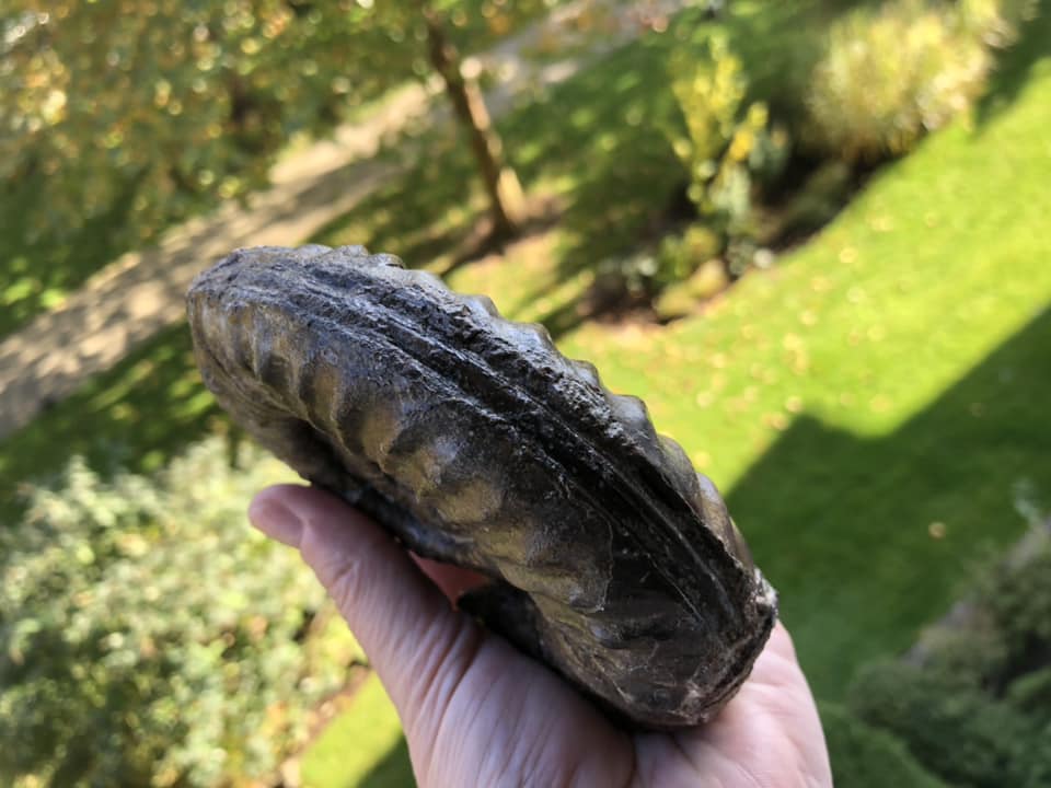
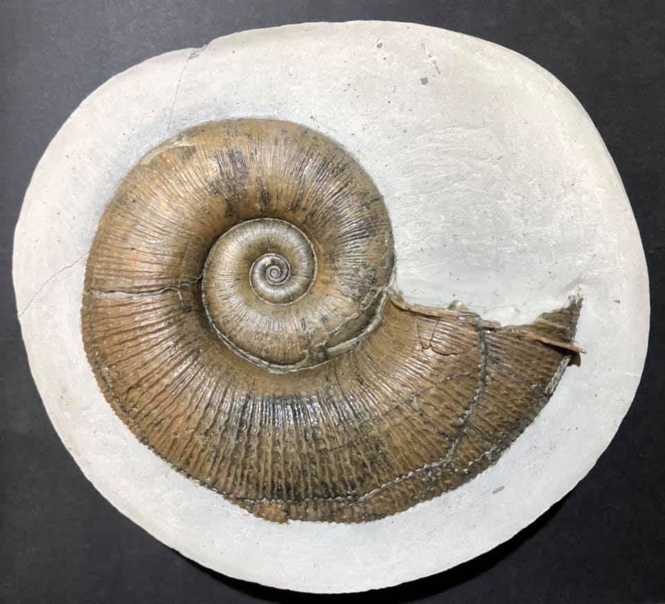
| Titanites occidentalis, Fernie Ammonite |
This beauty is the remains of a carnivorous cephalopod within the family Dorsoplanitidae that lived and died in a shallow sea some 150 million years ago.
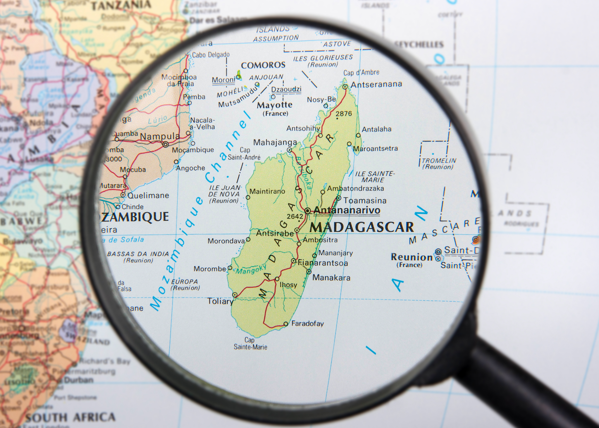
If you would like to get off the beaten track and hike up to see this ancient beauty, you will want to head to the town of Fernie in British Columbia close to the Alberta border.
This is the traditional territory of the the Yaq̓it ʔa·knuqⱡi ‘it First Nation who have lived here since time immemorial. There was some active logging along the hillside in 2021, so if you are looking at older directions on how to get to the site be mindful that many of the trailheads have been altered and a fair bit of bushwhacking will be necessary to get to the fossil site proper. That being said, the loggers from CanWel may have clear-cut large sections of the hillside but they did give the ammonite a wide berth and have left it intact.
Wildsight, a non-profit environmental group out of the Kimberly Cranbrook area has been trying to gain grant funding to open up the site as an educational hike with educational signage for folks visiting the Fernie area. It is likely the province of British Columbia would top up those funds if they are able to place the ammonite under the Heritage Conservation Act. CanWel would remain the owners of the land but the province could assume the liability for those visiting this iconic piece of British Columbia's palaeontological history.
Driving to the trail base is along an easy access road just east of town along Fernie Coal Road. There are some nice exposures of Cretaceous plant material on the north side (left-hand side) of the road as you head from Fernie towards Coal Creek. I recently drove up to Fernie to look at Cretaceous plant material and locate the access point to the now infamous Late Jurassic (Tithonian) Titanites (S.S. Buckman, 1921) site. While the drive out of town is on an easy, well-maintained road, the slog up to the ammonite site is often a wet, steep push. This time of year, it is buried in a blanket of crisp, white snow.
 |
| Fernie, British Columbia, Canada |
Titanites occidentalis, the Western Giant, is the second known specimen of this extinct fossil species.
The first was discovered in 1947 in nearby Coal Creek by a British Columbia Geophysical Society mapping team. When they first discovered this marine fossil high up on the hillside, they could not believe their eyes — both because it is clearly marine at the top of a mountain and the sheer size of this ancient beauty.
In the summer of 1947, on a warm summer's day, a field crew was mapping coal outcrops for the BC Geological Survey (GSC) east of Fernie. One of the students reported finding “a fossil truck tire.” Fair enough. The similarity of size and optics are pretty close to your average Goodridge.
A few years later, GSC Paleontologist Hans Frebold described and named the fossil Titanites occidentalis after the large Jurassic ammonites from Dorset, England. The name comes from Greek mythology. Tithonus, as you may recall, was the Prince of Troy. He fell in love with Eos, the Greek Goddess of the Dawn. Eos begged Zeus to make her mortal lover immortal. Zeus granted her wish but did not grant Tithonus eternal youth. He did indeed live forever — ageing hideously. Ah, Zeus, you old trickster. It is a clever play on time placement. Dawn is the beginning of the day and the Tithonian being the latest age of the Late Jurassic. Clever Hans!
HIKING TO THE FERNIE AMMONITE
From the town of Fernie, British Columbia, head east along Coal Creek Road towards Coal Creek. The site is 3.81 km from the base of Coal Creek Road to the trailhead as the crow flies. I have mapped it here for you in yellow and added the wee purple GPS marker for the ammonite site proper. There is a nice, dark grey to black roadcut exposure of Cretaceous plants on the north side of the dirt road that is your cue to pull over and park.
You access what is left of the trailhead on the south side of the road. You will need to cross the creek to begin your ascent. There is no easy way across the creek and you'll want to tackle this one with a friend when the water level is low.
The beginning of the trail is not clear but a bit of searching will reveal the trailhead with its telltale signs of previous hikers. This is a moderate 6.3-kilometre hike up & back bushwhacking through scrub and fallen trees. Heading up, you will make about a 246-metre elevation gain. You will likely not have a cellular signal up here but if you download the Google Map to your mobile, you will have GPS to guide you. The area has been recently logged so much of the original trail has been destroyed. There may now be easier vehicle access up the logging roads but I have not driven them since the logging and new road construction.
If you are coming in from out of town, the closest airport is Cranbrook. Then it is about an hour and change to Fernie and another 15-minutes or so to park near the site.

This is a site you will want to wear hiking boots to access. Know that these will get wet as you cross the creek.
If you would like to see the ammonite but are not keen on the hike, a cast has been made by fossil preparator Rod Bartlett is on display at the Courtenay Museum in Courtenay, Vancouver Island, Canada.
Respect for the Land / Leave No Trace
As your feet move up the hillside, you can imagine this land 10,000 years ago, rising above great glaciers. Where footfalls trace the steps of those that came before you. This land has been home to the Yaq̓it ʔa·knuqⱡi ‘it First Nation and Ktunaxa or Kukin ʔamakis First Nations whose oral history have them living here since time immemorial. Like them, take only what you need and no more than the land offers — packing out anything that you packed in.
Fernie Ammonite Palaeo Coordinates: 49°29'04"N 115°00'49"W


.png)