Showing posts with label fossils. Show all posts

Sunday 5 March 2023

KI'A'PALANO: STONE, BONE AND WATER

Cretaceous Plant Material / Three Brothers Formation
Vancouver has a spectacular mix of mountains, forests, lowlands, inlets and rivers all wrapped lovingly by the deep blue of the Salish Sea. 

When we look to the North Shore, the backdrop is made more spectacular by the Coast Mountains with a wee bit of the Cascades tucked in behind.

If you were standing on the top of the Lion's Gate Bridge looking north you would see the Capilano Reservoir is tucked in between the Lions to the west and Mount Seymour to the east on the North Shore. 

The bounty of that reservoir flows directly into your cup. If you look down from the reservoir you see the Capilano River as it makes its way to the sea and enters Burrard Inlet.

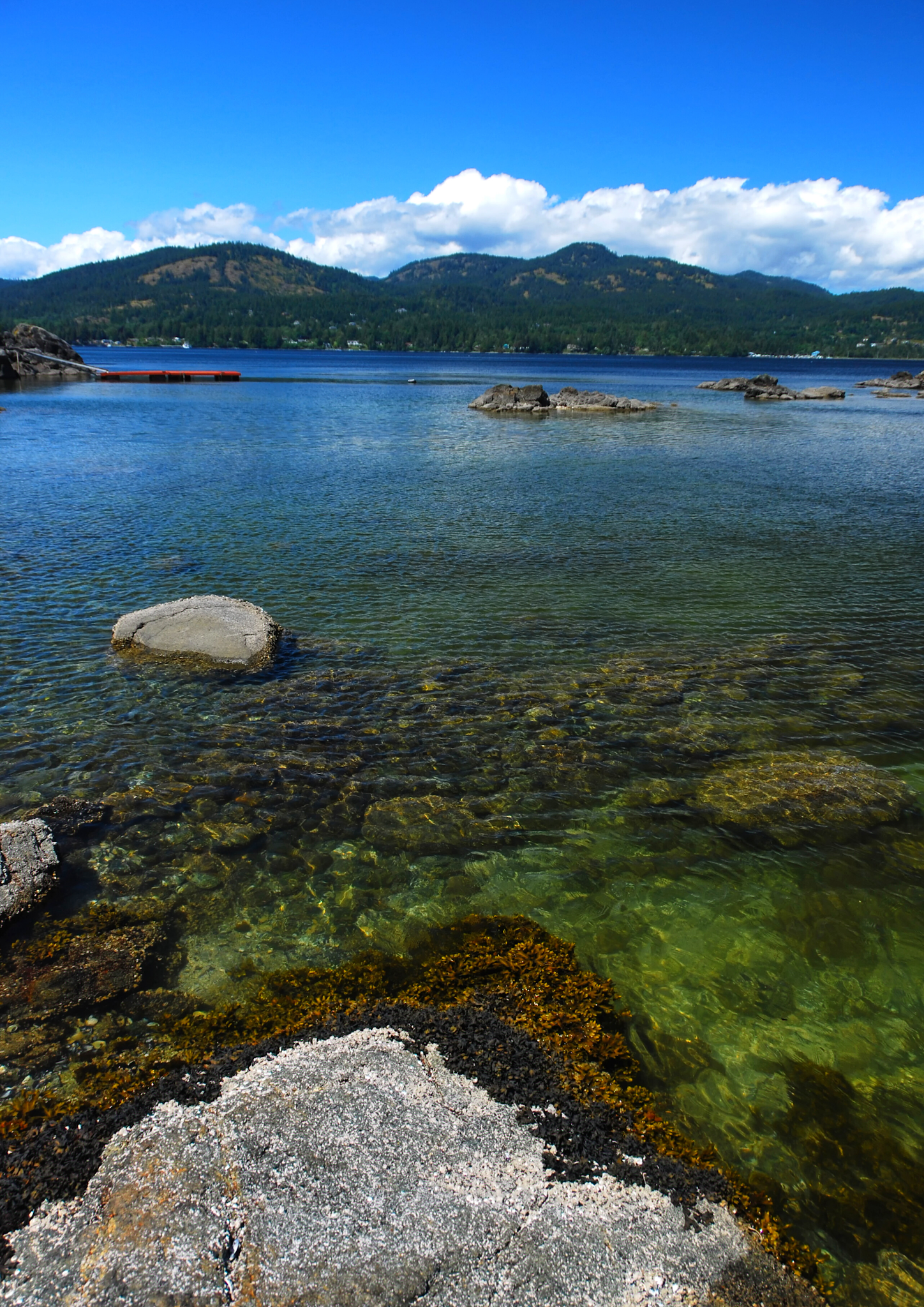
The Capilano River on Vancouver's North Shore flows through the Coast Mountains and our coastal rainforest down to the Capilano watershed enroute to Burrard Inlet. The headwaters are at the top of Capilano up near Furry Creek. They flow down through the valley, adding in rainwater, snowmelt and many tributaries before flowing into Capilano Lake. The lake in turn flows through Capilano Canyon and feeds into the Capilano River.

Today, for many, the Capilano River is the clear, cold water with which we fill our cups. But not so long ago, this Kia’palano, this beautiful river, was the entry point to Homulchesan, traditionally called X̱wemelch'stn, whose name means fast-moving water of fish and the domain of Douglas fir trees and the wild sacred salmon who spawn here.

Capilano Watershed & Reservoir
Sacred First Nations Land

This area was once the exclusive domain of the Coast Salish First Nations —  xʷmə?kʷəyəm (Musqueam), Skwxwú7mesh (Squamish), and səlilwətaɬ (Tsleil-Waututh) Nations until the early 1800s. 

The Musqueam First Nation are traditional hən̓q̓əmin̓əm̓ speaking people who number a strong and thriving 1,300. Many live today on a wee slip of their traditional territory just south of Marine Drive near the mouth of the Fraser River. 

The Secwepemc or Shuswap First Nations are a collective of 17 bands occupying the south-central part of British Columbia. Their ancestors have lived in the interior of BC, the Secwepemc territories, for at least 10,000 years.

The Coast Salish First Nations have lived in this region for thousands of years — from the mouth of the Columbia River in Oregon to north of Bute Inlet. They ancestors of those who live here today braved the cold, following the receding of the ice to forge new roots, build villages and strengthen their connections to this land.   
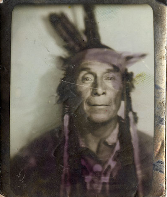
It is to the Squamish Nation that we owe the name of Capilano which is an anglicized version of Kia'palano. 

In Sḵwx̱wú7mesh snichim or Skwxwú7mesh, their spoken language, Kia'palano/Capilano means beautiful river

Chief Kia'palano (c. 1854-1910) was the Chief of the Squamish Nation from 1895-1910 — and Chief of the territory where this beautiful river flows — Sa7plek.
 
The Cleveland Dam — Capilano River Regional Park

Many things have changed since then, including the Capilano River's path, water levels and sediment deposition. For the salmon who used this path to return home and those who depended on them, life has been forever altered by our hands. The Capilano River still runs with Summer Coho, Spring & Summer Steelhead and Autumn Chinook. The small numbers of Spring/Summer Steelhead are maintained through catch and release and may one day reach their former levels of plenty along Vancouver’s North Shore. Elsewhere, we are beginning to see a rewilding of Vancouver with the return of the salmon to our rivers these past few years. 

It is a hopeful recovery from an amazing creature and their will to not just survive but thrive. Marina Dodis, a local film maker has done a wonderful job of recording that rewilding in her film, The Return. I'll pop a link below for you to watch it. I'm sure you'll enjoy it as much as I did.

We have Ernest Albert Cleveland to thank for the loss of that salmon but can credit him with much of our drinking water as it is caught and stored by the dam that bears his name. It was his vision to capture the bounty from the watershed and ensure it made its way into our cups and not the sea. 

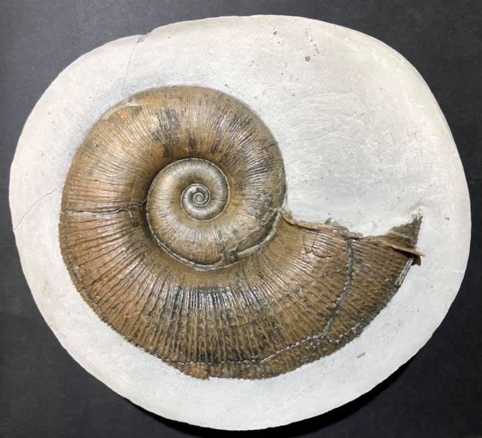
Both the water and a good deal of sediment from the Capilano would flow into Burrard Inlet if not held back by the 91-metre concrete walls of the Cleveland Dam. While it was not Ernest's intention, his vision and dam had a secondary impact. In moving the mouth of the Capilano River he altered the erosion pattern of the North Shore and unveiled a Cretaceous Plant Fossil outcrop that is part of the Three Brothers Formation.

Capilano River Canyon & Regional Park
Know Before You Go

The fossil site is easily accessible from Vancouver and best visited in the summer months when water levels are low. 

The level of preservation of the fossils is quite good. The state in which they were fossilized, however, was not ideal. They look to have been preserved as debris that gathered in eddies in a stream or delta.

There are Cretaceous fossils found only in the sandstone. You will see exposed shale in the area but it does not contain fossil material. 

Interesting, but again not fossiliferous, are the many granitic and limestone boulders that look to have been brought down by glaciers from as far away as Texada Island. Cretaceous plant material (and modern material) found here include Poplar (cottonwood)  Populus sp. Bigleaf Maple, Acer machphyllum, Alder, Alnus rubra, Buttercup  Ranvuculus sp., Epilobrium, Red cedar, Blackberry and Sword fern.

Capilano Fossil Field Trip:

From downtown Vancouver, drive north through Stanley Park and over the Lion’s Gate Bridge. Take the North Vancouver exit toward the ferries. Turn right onto Taylor Way and then right again at Clyde Avenue. Look for the Park Royal Hotel. Park anywhere along Clyde Avenue.

From Clyde Avenue walk down the path to your left towards the Capilano River. Watch the water level and tread cautiously as it can be slippery if there has been any recent rain. Look for beds of sandstone about 200 meters north of the private bridge and just south of the Highway bridge. The fossil beds are just below the Whytecliff Apartment high rises. Be mindful of high water and slippery rocks.

Visiting the Capilano Watershed and Reservoir:

Visitors can see the reservoir from Cleveland Dam at the north end of Capilano River Regional Park. You can also visit the Capilano River Hatchery, operated below Cleveland Dam since 1971.

IN THE HEART OF THE CITY, A WILD MIRACLE AWAITS — THE RETURN, a film by the supremely talented Marina Dodis

There is something astonishing happening in the city of Vancouver. Largely unnoticed amidst vehicle traffic, industrial sites and construction, wild salmon are returning to their ancient spawning grounds.

Once an important salmon bearing area, this watershed became severely degraded as the city grew. The run collapsed and was declared “dead”. As salmon are iconic for people in British Columbia, concerned citizens became engaged. The rewilding has begun to pay off. After disappearing for 80 years, people can now witness the autumn spectacle of these powerful swimmers fighting to reach the streams they hatched in. To have a salmon run taking place within city limits is almost completely unique in a metropolis of this size.

Filmed with a quiet, observing lens over many years, "The Return" takes us into hidden enclaves of wilderness within the city, where tiny salmon smolts shimmer beneath the water's surface. Now that they have come back, their future is in our hands.

Link: https://madodis.wixsite.com/the-return?fbclid=IwAR349gFSZtmb3FN4iZRP6AGLyTH0O7MQnQbY-Prup6Qa0ICUzdhaw3vCkSk

Tuesday 7 February 2023

FOSSILS OF TURTLE ISLAND'S EASTERN SHORES

Hylonomus lyelli, Ancestor of all dinosaurs
The fossil cliffs at Joggins are one of Canada's gems, now a UNESCO World Heritage Site, you can visit to see our ancient world frozen in time. 

Preserved in situ is a snapshot of an entire food chain of a terrestrial Pennsylvanian Coal Age wetland.

The outcrop holds fossil plant life — including impressive standing lycopsid trees that formed the framework of these wetlands — decomposing detritivores in the invertebrates and tetrapods, the predatory carnivores of the day.

The Coal Age trees were fossilized where they stood 300-million-years ago with the remains of the earliest reptiles entombed within. The preservation is quite marvellous with the footprints of creatures who once lived in these wetlands are frozen where they once walked and the dens of amphibians are preserved with remnants of their last meal. 

Nowhere is a record of plant, invertebrate and vertebrate life within now fossilized forests rendered more evocatively. The fossil record at Joggins contains 195+ species of plants, invertebrates and vertebrates. The fossil plant life became the vast coal deposits for which this period of Earth's history is named. 

Recorded in the rock are vertebrate and invertebrate fauna both aquatic and terrestrial. This broad mix of specimens gives us a view into life back in the Pennsylvanian and sets us up to understand their ecological context.
Pennsylvanian Coal Age Ecosystem, 300-Million-Years-Old
The fossil record includes species first defined at Joggins, some of which are found nowhere else on Earth. 

It was here that Sir Charles Lyell, with Sir William Dawson, founder of modern geology, discovered tetrapods — amphibians and reptiles — entombed in the upright fossil trees. 

Later work by Dawson would reveal the first true reptile, Hylonomus lyelli, ancestor of all dinosaurs that would rule the Earth 100 million years later. 

This tiny reptile serves as the reference point where animals finally broke free of the water to live on land. This evolutionary milestone recorded at Joggins remains pivotal to understanding the origins of all vertebrate life on land, including our own species. 

Sir Charles Lyell, author of Principles of Geology, first noted the exceptional natural heritage value of the Joggins Fossil Cliffs, calling them “...the finest example in the world of a natural exposure in a continuous section ten miles long, occurs in the sea cliffs bordering a branch of the Bay of Fundy in Nova Scotia.” Indeed, the world-famous Bay of Fundy with its impressive tides, the highest in the world, and stormy nature exposed much of this outcrop. 

Geological accounts of the celebrated coastal section at Joggins first appear in the published literature in 1828–1829, by Americans C.T. Jackson and F. Alger, and by R. Brown and R. Smith, managers for the General Mining Association in the Sydney and Pictou coal fields. Brown and Smith’s account is the first to document the standing fossil trees.

Joggins Fossil Cliffs Map (Click to Enlarge)
Plan Your Joggins Fossil Cliffs Staycation

Joggins Fossil Cliffs is a Canadian gem — and they welcome visitors. They offer hands-on learning and discovery microscope activities in their Fossil Lab.

You can explore interpretive displays in the Joggins Fossil Centre before heading out to the beach and cliffs with an interpreter.

Their guided tours of the fossil site include an educational component that tells you about the geology, ecology, palaeontology and conservation of this very special site. 

Joggins / Chegoggin / Mi'kmaq L'nu

We know this area as Joggins today. In Mi'kmaw, the language spoken in Mi'kma'ki, the territory of the Mi'kmaq L'nu, the area bears another name, Chegoggin, place of fishing weirs.

Booking Your Class Field Trip

If you are a teacher and would like to book a class field trip, contact the Director of Operations via the contact information listed below. They will walk you through Covid safety and discuss how to make your visit educational, memorable and fun.

Know Before You Go

The Bay of Fundy has the highest tides in the world. Beach walks are scheduled according to the tides and run regardless of the weather. Good low tides but raining, the beach walk goes on. Lovely and sunny but with a high tide, the beach walk must wait. So, you will want to dress for it as they will not be cancelled in the event of rain. Should severe weather be a factor, bookings may need to be rescheduled at the discretion of the Joggins staff.

Any questions about booking your school field trip? Feel free to email:  operations@jogginsfossilcliffs.net or call: 1 (902) 251-2727 EXT 222.

References & further reading:

Joggins Fossil Cliffs: https://jogginsfossilcliffs.net/cliffs/history/

Image: Hylonomus lyelli, Una ricostruzione di ilonomo by Matteo De Stefano/MUSEThis file was uploaded by MUSE - Science Museum of Trento in cooperation with Wikimedia Italia., CC BY-SA 3.0, https://commons.wikimedia.org/w/index.php?curid=48143186

Image: Arthropleura: Par Tim Bertelink — Travail personnel, CC BY-SA 4.0, https://commons.wikimedia.org/w/index.php?curid=48915156

Joggins Map: Joggins Fossil Cliffs: https://jogginsfossilcliffs.net/cliffs/history/

Monday 6 February 2023

FOSSILS OF NOVA SCOTIA

Dendrerpeton acadianum, an extinct amphibian
One of the best Canadian fossil finds stems from a random boulder picked up on the beach near the town of Joggins, Nova Scotia. Inside were the bones of a fully articulated skeleton of Dendrerpeton acadianum, a Temnospondyli from the Lower Pennsylvanian. 

These little cuties belong to an extinct genus of amphibians who loved wet, swampy wetlands similar to those we find in the bayous of Mississippi today.   

Dendrerpeton is the primitive sister-group to a clade of Temnospondyls that includes Trimerorhachoids, the Eryopoids — Ervops, Parioxys, & Sclerocephalus — Zatracheids & Dissorophoids. 

This little guy along with finding the first true reptile, Hylonomus lyelli, ancestor of all dinosaurs that would rule the Earth 100 million years later serve as the reference point where animals finally broke free of the water to live on land. This evolutionary milestone recorded at Joggins remains pivotal to understanding the origins of all vertebrate life on land, including our own species. 

Joggins records life in a once a wet, swampy wetland
Sir Charles Lyell, the author of Principles of Geology, first noted the exceptional natural heritage value of the Joggins Fossil Cliffs. He described them as: 

“...the finest example in the world of a natural exposure in a continuous section ten miles long, occurs in the sea cliffs bordering a branch of the Bay of Fundy in Nova Scotia.” 

Indeed, the world-famous Bay of Fundy with its impressive tides, the highest in the world, and stormy nature exposed much of this outcrop. 

Friday 3 February 2023

FOSSILS IN THE LAND OF THE NUU-CHAH-NULTH FIRST NATIONS

Nootka Fossil Field Trip. Photo: John Fam
The rugged west coast of Vancouver Island offers spectacular views of a wild British Columbia. Here the seas heave along the shores slowly eroding the magnificent deposits that often contain fossils. 

Just off the shores of Vancouver Island, east of Gold River and south of Tahsis is the picturesque and remote Nootka Island.

This is the land of the proud and thriving Nuu-chah-nulth First Nations who have lived here always

Always is a long time, but we know from oral history and archaeological evidence that the Mowachaht and Muchalaht peoples lived here, along with many others, for many thousands of years — a time span much like always

While we know this area as Nootka Sound and the land we explore for fossils as Nootka Island, these names stem from a wee misunderstanding. 

Just four years after the 1774 visit by Spanish explorer Juan Pérez — and only a year before the Spanish established a military and fur trading post on the site of Yuquot — the Nuu-chah-nulth met the Englishman, James Cook.  

Captain Cook sailed to the village of Yuquot just west of Vancouver Island to a very warm welcome. He and his crew stayed on for a month of storytelling, trading and ship repairs. Friendly, but not familiar with the local language, he misunderstood the name for both the people and land to be Nootka. In actual fact, Nootka means, go around, go around

Two hundred years later, in 1978, the Nuu-chah-nulth chose the collective term Nuu-chah-nulth — nuučaan̓uł, meaning all along the mountains and sea or along the outside (of Vancouver Island) — to describe themselves. 

It is a term now used to describe several First Nations people living along western Vancouver Island, British Columbia. 

It is similar in a way to the use of the United Kingdom to refer to the lands of England, Scotland and Wales — though using United Kingdom-ers would be odd. Bless the Nuu-chah-nulth for their grace in choosing this collective name.  

An older term for this group of peoples was Aht, which means people in their language and is a component in all the names of their subgroups, and of some locations — Yuquot, Mowachaht, Kyuquot, Opitsaht. While collectively, they are the Nuu-chah-nulth, be interested in their more regional name should you meet them. 

But why does it matter? If you have ever mistakenly referred to someone from New Zealand as an Aussie or someone from Scotland as English, you have likely been schooled by an immediate — sometimes forceful, sometimes gracious — correction of your ways. The best answer to why it matters is because it matters.

Each of the subgroups of the Nuu-chah-nulth viewed their lands and seasonal migration within them (though not outside of them) from a viewpoint of inside and outside. Kla'a or outside is the term for their coastal environment and hilstis for their inside or inland environment.

It is to their kla'a that I was most keen to explore. Here, the lovely Late Eocene and Early Miocene exposures offer up fossil crab, mostly the species Raninid, along with fossil gastropods, bivalves, pine cones and spectacularly — a singular seed pod. These wonderfully preserved specimens are found in concretion along the foreshore where time and tide erode them out each year.

Five years after Spanish explorer Juan Pérez's first visit, the Spanish built and maintained a military post at Yuquot where they tore down the local houses to build their own structures and set up what would become a significant fur trade port for the Northwest Coast — with the local Chief Maquinna's blessing and his warriors acting as middlemen to other First Nations. 

Following reports of Cook's exploration British traders began to use the harbour of Nootka (Friendly Cove) as a base for a promising trade with China in sea-otter pelts but became embroiled with the Spanish who claimed (albeit erroneously) sovereignty over the Pacific Ocean. 

Dan Bowen searching an outcrop. Photo: John Fam
The ensuing Nootka Incident of 1790 nearly led to war between Britain and Spain (over lands neither could actually claim) but talk of war settled and the dispute was settled diplomatically. 

George Vancouver on his subsequent exploration in 1792 circumnavigated the island and charted much of the coastline. His meeting with the Spanish captain Bodega y Quadra at Nootka was friendly but did not accomplish the expected formal ceding of land by the Spanish to the British. 

It resulted however in his vain naming the island "Vancouver and Quadra." The Spanish captain's name was later dropped and given to the island on the east side of Discovery Strait. Again, another vain and unearned title that persists to this day.

Early settlement of the island was carried out mainly under the sponsorship of the Hudson's Bay Company whose lease from the Crown amounted to 7 shillings per year — that's roughly equal to £100.00 or $174 CDN today. Victoria, the capital of British Columbia, was founded in 1843 as Fort Victoria on the southern end of Vancouver Island by the Hudson's Bay Company's Chief Factor, Sir James Douglas. 

With Douglas's help, the Hudson's Bay Company established Fort Rupert on the north end of Vancouver Island in 1849. Both became centres of fur trade and trade between First Nations and solidified the Hudson's Bay Company's trading monopoly in the Pacific Northwest.

The settlement of Fort Victoria on the southern tip of Vancouver Island — handily south of the 49th parallel — greatly aided British negotiators to retain all of the islands when a line was finally set to mark the northern boundary of the United States with the signing of the Oregon Boundary Treaty of 1846. Vancouver Island became a separate British colony in 1858. British Columbia, exclusive of the island, was made a colony in 1858 and in 1866 the two colonies were joined into one — becoming a province of Canada in 1871 with Victoria as the capital.

Dan Bowen, Chair of the Vancouver Island Palaeontological Society (VIPS) did a truly splendid talk on the Fossils of Nootka Sound. With his permission, I have uploaded the talk to the ARCHEA YouTube Channel for all to enjoy. Do take a boo, he is a great presenter. Dan also graciously provided the photos you see here. The last of the photos you see here is from the August 2021 Nootka Fossil Field Trip. Photo: John Fam, Vice-Chair, Vancouver Paleontological Society (VanPS).

Know Before You Go — Nootka Trail

The Nootka Trail passes through the traditional lands of the Mowachaht/Muchalat First Nations who have lived here since always. They share this area with humpback and Gray whales, orcas, seals, sea lions, black bears, wolves, cougars, eagles, ravens, sea birds, river otters, insects and the many colourful intertidal creatures that you'll want to photograph.

This is a remote West Coast wilderness experience. Getting to Nootka Island requires some planning as you'll need to take a seaplane or water taxi to reach the trailhead. The trail takes 4-8 days to cover the 37 km year-round hike. The peak season is July to September. Permits are not required for the hike. 

Access via: Air Nootka floatplane, water taxi, or MV Uchuck III

  • Dan Bowen, VIPS on the Fossils of Nootka: https://youtu.be/rsewBFztxSY
  • https://www.thecanadianencyclopedia.ca/en/article/sir-james-douglas
  • file:///C:/Users/tosca/Downloads/186162-Article%20Text-199217-1-10-20151106.pdf
  • Nootka Trip Planning: https://mbguiding.ca/nootka-trail-nootka-island/#overview


Wednesday 1 February 2023

STEMEC SUNTOCUM: FOSSILS OF SOUTHERN VANCOUVER ISLAND

Stemec suntokum, Sooke Formation
The diving bird you see here is Stemec suntokum, a Fossil Plopterid from Sooke, British Columbia, Canada.

We all dream of finding new species, and new fossil species in particular. This happens more than you think. As impossible as it sounds, it has happened numerous times at many fossils sites in British Columbia including Sooke on Vancouver Island.

The upper Oligocene Sooke Formation outcrops at Muir Beach on southwestern Vancouver Island, British Columbia where it is flanked by the cool, clear waters of the Strait of Juan de Fuca.

While the site has been known since the 1890s, my first trip here was in the early 1990s as part of a Vancouver Paleontological Society (VanPS) fossil field trip. This easy, beach walk locality is a wonderful place to collect fossils and is especially good for families. If you are solar-powered, you will enjoy the sun playing off the surf from May through September. If you are built of hardier stuff, then the drizzle of Spring or Autumn is a lovely, un-people-y time to walk the beachfront.

As well as amazing west coast scenery, the beach site outcrop has a lovely soft matrix with well-preserved fossil molluscs, often with the shell material preserved (Clark and Arnold, 1923).

By the Oligocene ocean temperatures had cooled to near modern levels and the taxa preserved here as fossils bear a strong resemblance to those found living beneath the Strait of Juan de Fuca today. Gastropods, bivalves, echinoids, coral, chitin and limpets are common-ish — and on rare occasions, fossil marine mammals, cetacean and bird bones are discovered.

Fossil Bird Bones 

Back in 2013, Steve Suntok and his family found fossilized bones from a 25-million-year-old wing-propelled flightless diving bird while out strolling the shoreline near Sooke. Not knowing what they had found but recognizing it as significant, the bones were brought to the Royal British Columbia Museum to identify.

The bones found their way into the hands of Gary Kaiser. Kaiser worked as a biologist for Environment Canada and the Nature Conservatory of Canada. After retirement, he turned his eye from our extant avian friends to their fossil lineage. The thing about passion is it never retires. Gary is now a research associate with the Royal British Columbia Museum, published author and continues his research on birds and their paleontological past.

Kaiser identified the well-preserved coracoid bones as the first example from Canada of a Plotopteridae, an extinct family that lived in the North Pacific from the late Eocene to the early Miocene. In honour of the First Nations who have lived in the area since time immemorial and Steve Suntok who found the fossil, Kaiser named the new genus and species Stemec suntokum.

Magellanic Penguin Chick, Spheniscus magellanicus
This is a very special find. Avian fossils from the Sooke Formation are rare. We are especially lucky that the bird bone was fossilized at all.  These are delicate bones and tasty. Scavengers often get to them well before they have a chance and the right conditions to fossilize.

Doubly lucky is that the find was of a coracoid, a bone from the shoulder that provides information on how this bird moved and dove through the water similar to a penguin. It's the wee bit that flexes as the bird moves his wing up and down.

Picture a penguin doing a little waddle and flapping their flipper-like wings getting ready to hop near and dive into the water. Now imagine them expertly porpoising —  gracefully jumping out of the sea and zigzagging through the ocean to avoid predators. It is likely that the Sooke find did some if not all of these activities.

When preservation conditions are kind and we are lucky enough to find the forelimbs of our plotopterid friends, their bones tell us that these water birds used wing-propelled propulsion to move through the water similar to penguins (Hasegawa et al., 1979; Olson and Hasegawa, 1979, 1996; Olson, 1980; Kimura et al., 1998; Mayr, 2005; Sakurai et al., 2008; Dyke et al., 2011).

Kaiser published on the find, along with Junya Watanabe, and Marji Johns. Their work: "A new member of the family Plotopteridae (Aves) from the late Oligocene of British Columbia, Canada," can be found in the November 2015 edition of Palaeontologia Electronica. If you fancy a read, I've included the link below.

The paper shares insights into what we have learned from the coracoid bone from the holotype Stemec suntokum specimen. It has an unusually narrow, conical shaft, much more gracile than the broad, flattened coracoids of other avian groups. This observation has led some to question if it is, in fact, a proto-cormorant of some kind. We'll need to find more of their fossilized lineage to make any additional comparisons.

Sooke, British Columbia and Juan de Fuca Strait
Today, fossils from these flightless birds have been found in outcrops in the United States and Japan (Olson and Hasegawa, 1996). They are bigger than the Sooke specimens, often growing up to two metres.

While we'll never know for sure, the wee fellow from the Sooke Formation was likely about 50-65 cm long and weighed in around 1.72-2.2 kg — so roughly the length of a duck and weight of a small Magellanic Penguin, Spheniscus magellanicus, chick. 

To give you a visual, I have included a photo of one of these cuties here showing off his full range of motion and calling common in so many young.

The first fossil described as a Plotopteridae was from a wee piece of the omal end of a coracoid from Oligocene outcrops of the Pyramid Hill Sand Member, Jewett Sand Formation of California (LACM 8927). Hildegarde Howard (1969) an American avian palaeontologist described it as Plotopterum joaquinensis. Hildegarde also did some fine work in the La Brea Tar Pits, particularly her work on the Rancho La Brea eagles.

In 1894, a portion of a pelagornithid tarsometatarsus, a lower leg bone from Cyphornis magnus (Cope, 1894) was found in Carmanah Group on southwestern Vancouver Island (Wetmore, 1928) and is now in the collections of the National Museum of Canada as P-189401/6323. This is the wee bone we find in the lower leg of birds and some dinosaurs. We also see this same bony feature in our Heterodontosauridae, a family of early and adorably tiny ornithischian dinosaurs — a lovely example of parallel evolution.


While rare, more bird bones have been found in the Sooke Formation over the past decade. In 2013, three avian bones were found in a single year. The first two were identified as possibly being from a cormorant and tentatively identified as Phalacrocoracidae tibiotarsi, the large bone between the femur and the tarsometatarsus in the leg of a bird.

They are now in the collections of the Royal BC Museum as (RBCM.EH2013.033.0001.001 and RBCM.EH2013.035.0001.001). These bones do have the look of our extant cormorant friends but the specimens themselves were not very well-preserved so a positive ID is tricky.

The third (and clearly not last) bone, is a well-preserved coracoid bone now in the collection at the RBCM as (RBCM.EH2014.032.0001.001).

The fossil bird find was the first significant find by the Suntok family but not their last. Just last year, they found part of a fish dental plate was studied by Russian researcher Evgeny Popov who named this new genus and species of prehistoric fish Canadodus suntoki, which translates to the "Tooth from Canada." Perhaps not quite as inspired as Kaiser, but a lovely homage to these Citizen Scientists.

Sooke Fossil Fauna

Along with these rare bird bones, the Paleogene sedimentary deposits of the Carmanah Group on southwestern Vancouver Island have a wonderful diversity of delicate fossil molluscs (Clark and Arnold, 1923). Walking along the beach, look for boulders with white shelly material in them. You'll want to collect from the large fossiliferous blocks and avoid the cliffs. The lines of fossils you see in those cliffs tell the story of deposition along a strandline. Collecting from them is both unsafe and poor form as it disturbs nearby neighbours and is discouraged.

Sooke Formation Gastropods, Photo: John Fam
We find nearshore and intertidal genera such as Mytilus (mussels) and barnacles, as well as more typically subtidal predatory globular moon snails (my personal favourite), surf clams (Spisula, Macoma), and thin, flattened Tellin clams.

The preservation here formed masses of shell coquinas that cemented together but are easily worked with a hammer and chisel. Remember your eye protection and I'd choose wellies or rubber boots over runners or hikers.

You may be especially lucky on your day out. Look for the larger fossil bones of marine mammals and whales that lived along the North American Pacific Coast in the Early Oligocene (Chattian).

Concretions and coquinas on the beach have yielded desmostylid, an extinct herbivorous marine mammal, Cornwallius sookensis (Cornwall, 1922) and 40 cm. skull of a cetacean Chonecetus sookensis (Russell, 1968), and a funnel whale, a primitive ancestor of our Baleen whales. 

A partial lower jaw and molar possibly from a large, bear-like beach-dwelling carnivore, Kolponomos, was also found here. A lovely skull from a specimen of Kolponomos clallamensis (Stirton, 1960) was found 60 km southwest across the Strait of Juan de Fuca in the early Miocene Clallam Formation and published by Lawrence Barnes and James Goedert. That specimen now calls the Natural History Museum of Los Angeles County home and is in their collections as #131148.

Directions to Muir Creek Fossil Site at Sooke: 

From the town of Sooke west of Victoria, follow Highway 14 for about 14 kilometres. Just past the spot where the highway crosses Muir Creek, you will see a gravel parking area on your left. Pull in and park here. 

From the barrier, walk out to the beach and turn right (west) and walk until you see the low yellow-brown sandstone cliffs about 400 metres ahead. 

Look at the grey sandstone boulders on the beach with bits of white flecks in them. The fossil material here will most often be a whitish cream colour. Check for low tide before heading out and choose rubber boots for this beach adventure.

References: 

L. S. Russell. 1968. A new cetacean from the Oligocene Sooke Formation of Vancouver Island, British Colombia. Canadian Journal of Earth Science 5:929-933
Barnes, Lawrence & Goedert, James. (1996). Marine vertebrate palaeontology on the Olympic Peninsula. Washington Geology, 24(3):17-25.

Fancy a read? Here's the link to Gary Kaiser's paper: https://palaeo-electronica.org/content/2015/1359-plotopterid-in-canada. If you'd like to head to the beach site, head to: 48.4°N 123.9°W, paleo-coordinates 48.0°N 115.0°W.

Friday 27 January 2023

LOWER LIAS LYTOCERAS

A superbly prepped and extremely rare Lytoceras (Suess, 1865) ammonite found as a green ammonite nodule by Matt Cape in the Lower Lias of Dorset. 

Lytoceras are rare in the Lower Lias of Dorset — apart from the Belemnite Stone horizon — so much so that Paul Davis, whose skilled prep work you see here, initially thought it might be a Becheiceras hidden within the large, lumpy nodule. 

One of the reasons these lovelies are rarely found from here is that they are a Mediterranean Tethyian genus. The fossil fauna we find in the United Kingdom are dominated by Boreal Tethyian genera. 

We do find Lytoceras sp. in the Luridum subzone of the Pliensbachian showing that there was an influx of species from the Mediterranean realm during this time. This is the first occurrence of a Lytoceras that he has ever seen in a green nodule and Paul's seen quite a few. 

This absolutely cracking specimen was found and is in the collections of the awesome Matt Cape. Matt recognized that whatever was hidden in the nodule would take skilled and careful preparation using air scribes. Indeed it did. It took more than five hours of time and skill to unveil the lovely museum-worthy specimen you see here. 

We find Lytoceras in more than 1,000 outcrops around the globe ranging from the Jurassic through to the Cretaceous, some 189.6 to 109.00 million years ago. Once this specimen is fully prepped with the nodule material cut or scraped away, you can see the detailed crinkly growth lines or riblets on the shell and none of the expected coarse ribbing. 

Lytoceras sp. Photo: Craig Chivers
If you imagine running your finger along these, you would be tracing the work of decades of growth of these cephalopods. 

While we cannot know their actual lifespans, but we can make a healthy guess. 

The nautilus, their closest living cousins live upwards of 20 years — gods be good — and less than three years if conditions are poor.

The flanges, projecting flat ribs or collars, develop at the edge of the mouth border on the animal's mantle as they grow each new chamber. 

Each delicate flange grows over the course of the ammonites life, marking various points in time and life stages as the ammonite grew. There is a large variation within Lytoceras with regards to flanges. They provide both ornamentation and strength to the shell to protect it from water pressure as they moved into deeper seas.

The concretion prior to prep
This distinctive genus with its evolute shells are found in the Cretaceous marine deposits of: 

Antarctica (5 collections), Austria (19), Colombia (1), the Czech Republic (3), Egypt (2), France (194), Greenland (16), Hungary (25), Italy (11), Madagascar (2), Mexico (1), Morocco (4), Mozambique (1), Poland (2), Portugal (1), Romania (1), the Russian Federation (2), Slovakia (3), South Africa (1), Spain (24), Tanzania (1), Trinidad and Tobago (1), Tunisia (25); and the United States of America (17: Alaska, California, North Carolina, Oregon).

We also find them in Jurassic marine outcrops in:

Austria (15), Canada (9: British Columbia), Chile (6), France (181), Germany (11), Greenland (1), Hungary (189), India (1), Indonesia (1), Iran (1), Italy (50), Japan (14), Kenya (2), Luxembourg (4), Madagascar (2), Mexico (1), Morocco (43), New Zealand (15), Portugal (1), Romania (5), the Russian Federation (1), Slovakia (1), Spain (6), Switzerland (2), Tunisia (11), Turkey (12), Turkmenistan (1), Ukraine (5), the United Kingdom (12), United States (11: Alaska, California) — in at least 977 known collections. 

References:

Sepkoski, Jack (2002). "A compendium of fossil marine animal genera (Cephalopoda entry)". Bulletins of American Paleontology. 363: 1–560. Archived from the original on 2008-05-07. Retrieved 2017-10-18.

Paleobiology Database - Lytoceras. 2017-10-19.

Systematic descriptions, Mesozoic Ammonoidea, by W.J Arkell, Bernhard Kummel, and C.W. Wright. 1957. Treatise on Invertebrate Paleontology, Part L. Geological Society of America and University of Kansas press.

Thursday 19 January 2023

CERATIOCARIS, YE KEN

This braw fellow is Ceratiocaris papilio (Salter in Murchison, 1859) a pod Shrimp from the Silurian mudstones of the Kip Burn Formation in the Midland Valley of Scotland. He would have swam in rising seas filled with crinoids, coral reefs, brachiopods, trilobites and new and exotic fish -- some sporting jaws for the first time.

Ceratiocaris is a genus of extinct paleozoic phyllocarid crustacean whose fossils are found in marine strata from the Upper Ordovician through to the Silurian.

They are typified by eight short thoracic segments, seven longer abdominal somites and an elongated pretelson somite. Their carapace is slightly oval shaped; they have many ridges parallel to the ventral margin and possess a horn at the anterior end.

This tidy specimen is from the Silurian mudstones that characterise the Kip Burn Formation with it's dark laminated silty bands. The lower part of the Kip Burn houses the highly fossiliferous ‘Ceratiocaris beds’, that yield the arthropods Ceratiocaris, Dictyocaris, Pterygotus, Slimonia and the fish Birkenia and Thelodus.

The upper part of the formation, the ‘Pterygotus beds’, contain abundant eurypterid fauna together with the brachiopods Lingula and Ceratiocaris. The faunas in the Kip Burn Formation reflect the start of the transition from marine to quasi- or non-marine conditions in the group.

Ceratiocaris are also well known from the Silurian Eramosa Formation of Ontario, Canada (which also has rather nice eurypterids). Photo credit / collection of: York Yuxi Wang and Tianyi Zhang

Joseph H. Collette; David M. Rudkin (2010). "Phyllocarid crustaceans from the Silurian Eramosa Lagerstätte (Ontario, Canada): taxonomy and functional morphology". Journal of Paleontology. 84 (1): 118–127. doi:10.1666/08-174.1.

M. Copeland; T. E. Bolton (1985). Fossils of Ontario part 3: the eurypterids and phyllocarids. Volume 48 of Life Sciences Miscellaneous Publications. Royal Ontario Museum. ISBN 0-88854-314-X.

Tuesday 17 January 2023

PTEROSAURS AND SARODONTID FISH OF HORNBY ISLAND

Quetzalcoatlus
If you could travel through time and go back to observe our ancient skies, you would see massive pterosaurs — huge, winged flying reptiles of the extinct order Pterosauria — cruising along with you.

They soared our skies during most of the Mesozoic — from the late Triassic to the end of the Cretaceous (228 to 66 million years ago). 

By the end of the Cretaceous, they had grown to giants and one of their brethren, Quetzalcoatlus, a member of the family Azhdarchidae, boasts being the largest known flying animal that ever lived. They were the earliest vertebrates known to have evolved powered flight. Their wings were formed by a membrane of skin, muscle, and other tissues stretching from the ankles to a dramatically lengthened fourth finger.

We divide their lineage into two major types: basal pterosaurs and pterodactyloids. Basal pterosaurs — also called 'non-pterodactyloid pterosaurs' or ‘rhamphorhynchoids’ — were smaller with fully toothed jaws and longish tails. Their wide wing membranes connected to their hind legs giving them some maneuverability on the ground, but with an awkward sprawling posture. Picture a bat trying to walk or crawl along — doable but painful to watch. They were better climbers with flexible joint anatomy and strong claws. Basal pterosaurs preferred to dine on insects and small vertebrates.

Later pterosaurs (pterodactyloids) evolved many sizes, shapes, and lifestyles. Pterodactyloids had narrower wings with free hind limbs, highly reduced tails, and long necks with large heads. On the ground, pterodactyloids walked better than their earlier counterparts, maneuvering all four limbs smoothly with an upright posture. 

They walked standing plantigrade on the hind feet and folding the wing finger upward to walk on the three-fingered "hand." These later pterosaurs were more nimble. They could take off from the ground, run and wade and swim. Their jaws had horny beaks and some of these later groups lacked the teeth of earlier lineages. Some groups developed elaborate head crests that were likely used to attract mates' sexy-pterosaur style.

So can we or have we found pterosaurs on Hornby Island? The short answer is yes.

Collishaw Point, known locally as Boulder Point, Hornby Island
Hornby Island is a lovely lush, island in British Columbia's northern Gulf Islands. It was formed from sediments of the upper Nanaimo Group which are also widely exposed on adjacent Denman Island and the southern Gulf Islands.

Peter Mustard, a geologist from the Geologic Survey of Canada, did considerable work on the geology of the island. It has a total stratigraphic thickness of 1350 m of upper Nanaimo Group marine sandstone, conglomerate and shale. 

These are partially exposed in the Campanian to the lower Maastrichtian outcrops at Collishaw Point on the northwest side of Hornby Island. Four formations underlie the island from oldest to youngest, and from west to east: the Northumberland, Geoffrey, Spray and Gabriola.

During the upper Cretaceous, between ~90 to 65 Ma, sediments derived from the Coast Belt to the east and the Cascades to the southeast poured seaward to the west and northwest into what was the large ancestral Georgia Basin. This major forearc basin was situated between Vancouver Island and the mainland of British Columbia. The rocks you find here originated far to the south in Baja California and are the right age and type of sediment for a pterosaur find. But are we California dreaming?

Upper Cretaceous Nanaimo Group Fossil Concretion
Well, truth be told, we were with one of the potential pterosaur finds from Hornby. 

It wasn't just hopeful thinking that had the west coast in a paleo uproar many ago when Sharon Hubbard of the Vancouver Island Palaeontological Society found what looked very much like a pterosaur.

Right time period. Right location. And, we have found them here in the past. Sandy McLachlan found the first definitive pterosaur, an azhdarchid, back in 2008.

But was Sharon's find a pterosaur? Victoria Arbour, a Canadian evolutionary biologist and palaeontologist working as a Natural Sciences and Engineering Research Council of Canada postdoctoral fellow at the University of Toronto and Royal Ontario Museum, certainly thought so. 

While Arbour is an expert on ankylosaurs, our lumbering armoured dinosaurs friends, she has studied pterosaurs and participated in the naming of Gwawinapterus from Hornby Island. But here's the thing — bony material encased in stone and let to cement for millions of years can be tricky.

While this fossil find was initially described as a very late-surviving member of the pterosaur group Istiodactylidae, further examination cast doubt on the identification. Once more detail was revealed the remains were published as being those of a saurodontid fish, an ambush predator with very sharp serrated teeth and elongate, torpedo-like bodies that grew up to two meters. 

Not a pterosaur but still a massively exciting find. Arbour was very gracious at the renaming, taking it in stride. She has since gone on to name a partial ornithischian dinosaur from Sustut Basin, as well as the ankylosaurs Zuul, Zaraapelta, Crichtonpelta, and Ziapelta. But she may have another shot at a pterosaur.

Dan Bowen, Chair, VIPS. Photo: Deanna Steptoe Graham
In 2019, Dan Bowen, Chair of the Vancouver Island Palaeontological Society and a truly awesome possum, found some very interesting bones in concretion on Hornby. 

The concretion was nestled amongst the 72 million-year-old grey shales of the Northumberland Formation, Campanian to the lower Maastrichtian, part of the Cretaceous Nanaimo Group from Collishaw Point.

The site is known as Boulder Point to the locals and it has been a popular fossil destination for many years. It is the same site where Sharon made her find years earlier.

The concretion contains four articulated vertebrae that looked to be fish at first glance. Jay Hawley, a local fossil enthusiast was asked to prep the block to reveal more details. Once the matrix was largely removed the vertebrae inside were revealed to be bird bones, not fish and not another saurodontid as originally thought. Palaeontologist Victoria Arbour was called back in to put her keen lens on the discovery. 

You will appreciate that she took a good long look at the specimen and confirmed it to be a bird or a pterosaur. We still do not have confirmation on which it is as yet. The delicate bony material is very flattened with a very shallow u-shape on the bottom but will need additional study to confirm if the skies above California were once home to a great pterosaur who died, was fossilized then rode our tectonic plates to now call Hornby home. It is a great story and one that I am keen to follow.

References: To learn more about the azhdarchid remains found by Sandy McLachlan, check out the paper by Martin-Silverston et al. 2016.

Sunday 15 January 2023

FOSSILS AND GEOLOGY OF THE EAST KOOTENAY REGION

Tanglefoot Mountain. Photo: Dan Bowden
The East Kootenay region on the south-eastern edge of British Columbia is a land of colossal mountains against a clear blue sky. 

That is not strictly true, of course, as this area does see its fair share of rain and temperature extremes — but visiting in the summer every view is a postcard of mountainous terrain.

Rocks from deep within the Earth's crust underlie the entire East Kootenay region and are commonly exposed in the area's majestic mountain peaks, craggy rocky cliffs, glaciated river canyons, and rock cuts along the highways. Younger Ice Age sediments blanket much of the underlying rock.

I have been heading to the Cranbrook and Fernie area since the early 1990s. My interest is the local geology and fossil history that these rocks have to tell. I am also drawn to the warm and welcoming locals who share a love for the land and palaeontological treasures that open a window to our ancient past.  

Cranbrook is the largest community in the region and is steeped in mining history and the opening of the west by the railway. It is also a stone's throw away from Fort Steele and the Lower Cambrian exposures of the Eager Formation. These fossil beds rival the slightly younger Burgess Shale fauna and while less varied, produce wonderful examples of olenellid trilobites and weird and wonderful arthropods nearly half a billion years old. 

Labiostria westriopi, McKay Group
The Lower Cambrian Eager Formation outcrops at a few localities close to Fort Steele, many known since the early 1920s, and up near Mount Grainger near the highway. 

Further east, the Upper Cambrian McKay Group near Tanglefoot Mountain is a palaeontological delight with fifteen known outcrops that have produced some of the best-preserved and varied trilobites in the province — many of them new species. 

The McKay Formation also includes Ordovician outcrops sprinkled in for good measure.

Other cities in the area and the routes to and from them produce other fossil fauna from Kimberley to Fernie and the district municipality of Invermere and Sparwood. This is an arid country with native grasslands and forests of semi-open fir and pine. Throughout there are a host of fossiliferous exposures from Lower Cretaceous plants to brachiopods. 

The area around Whiteswan Lake has wonderful large and showy Ordovician graptolites including Cardiograptus morsus and Pseudoclimacograptus angustifolius elongates — some of our oldest relatives. A drive down to Flathead will bring you to ammonite outcrops and you can even find Eocene fresh-water snails in the region. 

The drive from Cranbrook to Fernie is about an hour and change through the Cambrian into the Devonian which flip-flops and folds over revealing Jurassic exposures. On my last visit, I made the trip with local geologist Guy Santucci who swings around the hairpin bends with panache. He is a delight to travel with and interspersed great conversation with tasty bits of information on the local geology.

Fernie Ichthyosaur Excavation, 1916
The Crowsnest Highway into Fernie follows Mutz Creek. From the highway, you can see the Fernie Group and the site along the Elk River where an ichthyosaur was excavated in 1916. 

The Fernie Formation is Jurassic. It is present in the western part of the Western Canada Sedimentary Basin in western Alberta and northeastern British Columbia. 

It takes its name from the town of Fernie, British Columbia, and was first defined by W.W. Leach in 1914. The town of Fernie is rimmed by rugged mountains tipped with Devonian marine outcrops. In essence, all these mountains are upside down with the oldest layers flipped to the top and a good 180 million years older than those they sit upon. 

Before they were mountains, these sedimentary rocks were formed as sediment collected in a shallow sea or inland basin. About 360 million years ago, the rocks that you see in Fernie today were down near the equator. They road tectonic plates, pushing northeast smashing into the coastline of what would become British Columbia. A little push here, shove there — compression and thrust faulting — and the rock was rolled over on its head — repeatedly. But that is how mountains are often formed, though not usually pushed so hard that they flip over. But still, it is a slow, relentless business. 

Cretaceous Plant Material, Fernie, BC
Within Fernie, there are small exposures of Triassic and Jurassic marine outcrops. East of the town there are Cretaceous plant sites, and of course, the Jurassic 1.4-metre Titanites occidentalis ammonite up on Coal Mountain.

Once up at the fossil exposures we begin to look for treasures. Over the next four or five hours, as the heat of the day sets in, we find block after block of dark brown to beige Cretaceous material embedded with coal seams and lithified fossil remains.

The regional district's dominant landform is the Rocky Mountain Trench, which is flanked by the Purcell Mountains and the Rocky Mountains on the east and west, and includes the Columbia Valley region. The southern half of which is in the regional district — its northern half is in the Columbia-Shuswap Regional District. 

The regional district of Elk Valley in the southern Rockies is the entryway to the Crowsnest Pass and an important coal-mining area. 

Other than the Columbia and Kootenay Rivers, whose valleys shape the bottomlands of the Rocky Mountain Trench, the regional districts form the northernmost parts of the basins of the Flathead, Moyie and Yahk Rivers. 

The Moyie and Yahk are tributaries of the Kootenay, entering it in the United States, and the Flathead is a tributary of the Clark Fork into Montana.

Photo One: Tyaughton Mountain, Mckay Group taken by Dan Bowden via drone; Photo Two: Labiostria westriopi, Upper Cambrian McKay Group, Site ML (1998); John Fam Collection; Photo Three: Ichthyosaur Excavation, Fernie, British Columbia, 1916; Photo Four: Cretaceous Plant Fossils, east of Fernie towards Coal Mountain. The deeply awesome Guy Santucci as hand-model for scale. 

FOSSIL FAUNA OF THE OLYMPIC PENINSULA

Vertipecten fucanus (Dall, 1898), Clallam Formation, WA
Some water-worn samples of the fossil bivalve Vertipecten fucanus from Lower Miocene deposits in the Clallam Formation.

These lovelies were collected on the foreshore near Clallam Bay, Olympic Peninsula, northwestern Washington on a lovely fossil field trip I did with my mother years ago.

Range zones of pectinid bivalves provide a principal means of age determination and correlation of shallow-water, inshore facies from California, through to Washington state and up to the head of the Gulf of Alaska.

Until Addicott's study from 1976, the area was considered middle Miocene. The new Lower Miocene designation can be credited in large part to the restricted stratigraphic range of Vertipecten fucanus (Dall, 1898) and the restricted and overlapping ranges of several other fossil mollusks collected from Alaska to California.

Neogene marine sediments of the West Coast of North America were deposited in a series of widely spaced basins that extended geographically from the western and northern Gulf of Alaska (60°N) to southern California (33°N). Rich molluscan faunas occur extensively throughout these deposits and form the basis for biostratigraphic schemes that are useful for correlating within and between individual basins.

Arturia angustata nautiloid, Clallam Formation, WA
Early biostratigraphic work was concerned with faunas from particular horizons and with the stratigraphic range of diverse taxa, such as Pecten and Turritella, without reference to other fossil groups.

Succeeding work increasingly dealt with the relationships of molluscan zones to benthic and, later, planktonic foraminiferal stages. In recent years the age limits of Neogene molluscan stages have become better documented by reference to planktonic microfossils from dated DSDP cores and onshore faunas. As our tools get better, our insight into these faunal groups and their correlation with their cousins to the south and over in the Pacific become clearer.

Neogene molluscan faunas from California, the Pacific Northwest states (Oregon and Washington), and southern Alaska have been treated separately due to differences in faunal composition and geographic isolation. As a result, a different biostratigraphic sequence has been described for each region.

Pacific Northwest stages have been formally named and defined. This naming structure is also used informally for Alaskan faunas. California Neogene stages were proposed early in this century, are in need of redescription, and their usage is informal. Precise correlations between the three regional sequences have not yet been achieved, due to the low number of co-occurring species and the general lack of planktonic microfossils in these largely shallow-water faunas. The objectives of ongoing research include the documentation of the faunas of California and Pacific Northwest stages; formal description of California stages; an improved correlation between regional stage sequences; refinement of age estimates for stage boundaries; and, the establishment of Neogene stages for Alaskan faunas.

Saturday 14 January 2023

FOUR TUSKS AND A TRUNK: TETRALOPHODON

Tetralophodon ("four-ridged tooth") is an extinct proboscidean genus belonging to the superfamily Elephantoidea. 

Their fossils have been found from the late Miocene to the Middle Pliocene of Europe, Asia, and Africa, which means many of our ancestors would have had the opportunity to see and hunt them. Lucky for them, these large elephant-like animals preferred fruits and vegetables. 

Like the gomphotheres, to which it was not closely related, Tetralophodon had an impressive four tusks and a trunk. They were big and on size with our modern elephants. You and I would come up to their hip bone on average. They were about 2.58–3.45 m (8.5–11.3 ft) tall at the shoulder and up to 10 tonnes in weight, larger than the size of the present Asian elephant, with a long trunk and incisors ranging up to 2 m (6.6 ft) long. 

Monday 14 November 2022

FIRST DINOSAUR FROM VANCOUVER ISLAND

This dapper fellow is a pine needle and horsetail connoisseur. He's a hadrosaurus — a duck-billed dinosaur. They were a very successful group of plant-eaters that thrived throughout western Canada during the late Cretaceous, some 70 to 84 million years ago.

Hadrosaurs lived as part of a herd, dining on pine needles, horsetails, twigs and flowering plants.

Hadrosaurs are ornithischians — an extinct clade of mainly herbivorous dinosaurs characterized by a pelvic structure superficially similar to that of birds. They are close relatives and possibly descendants of the earlier iguanodontid dinosaurs. 

They had slightly webbed, camel-like feet with pads on the bottom for cushioning and perhaps a bit of extra propulsion in water. They were primarily terrestrial but did enjoy feeding on plants near and in shallow water. There had a sturdy build with a stiff tail and robust bone structure. 

At their emergence in the fossil record, they were quite small, roughly three meters long. That's slightly smaller than an American bison. They evolved during the Cretaceous with some of their lineage reaching up to 20 meters or 65 feet.

Hadrosaurs are very rare in British Columbia but a common fossil in our provincial neighbour, Alberta, to the east. Here, along with the rest of the world, they were more abundant than sauropods and a relatively common fossil find. They were common in the Upper Cretaceous of Europe, Asia, and North America.

There are two main groups of Hadrosaurs, crested and non-crested. The bony crest on the top of the head of the hadrosaurs was hollow and attached to the nasal passages. It is thought that the hollow crest was used to make different sounds. These sounds may have signalled distress or been the hadrosaur equivalent of a wolf whistle used to attract mates. Given their size it would have made for quite the trumpeting sound.

This beautiful specimen graces the back galleries of the Courtenay and District Museum on Vancouver Island, British Columbia, Canada. I was very fortunate to have a tour this past summer with the deeply awesome Mike Trask joined by the lovely Lori Vesper. The museum houses an extensive collection of palaeontological and archaeological material found on Vancouver Island, many of which have been donated by the Vancouver Island Palaeontological Society.

Dan Bowen, Chair of the Vancouver Island Palaeontological Society, shared the photo you see here of the first partly articulated dinosaur from Vancouver Island ever found. The vertebrate photo and illustration are from a presentation by Dr. David Evans at the 2018 Paleontological Symposium in Courtenay.  The research efforts of the VIPS run deep in British Columbia and this new very significant find is no exception. A Hadrosauroid dinosaur is a rare occurrence and further evidence of the terrestrial influence in the Upper Cretaceous, Nanaimo Group, Vancouver Island — outcrops that we traditionally thought of as marine from years of collecting well-preserved marine fossil fauna.

CDM 002 / Hadrosauroid Caudal Vertebrae
The fossil bone material was found years ago by Mike Trask of the Vancouver Island Palaeontological Society. You may recall that he was the same fellow who found the Courtenay Elasmosaur on the Puntledge River.

Mike was leading a fossil expedition on the Trent River. While searching through the Upper Cretaceous shales, the group found an articulated mass of bones that looked quite promising.

Given the history of the finds in the area, the bones were thought to be from a marine reptile.

Since that time, we've found a wonderful terrestrial helochelydrid turtle, Naomichelys speciosa, but up to this point, the Trent had been known for its fossil marine fauna, not terrestrial. Efforts were made to excavate more of the specimen, and in all more than 25 associated vertebrae were collected with the help of some 40+ volunteers. Identifying fossil bone is a tricky business. Encased in rock, the caudal vertebrae were thought to be marine reptile in origin. Some of these were put on display in the Courtenay Museum and mislabeled for years as an unidentified plesiosaur.

In 2016, after years of collecting dust and praise in equal measure, the bones were reexamined. They didn't quite match what we'd expect from a marine reptile. Shino Sugimoto, Fossil Preparator, Vertebrate Palaeontology Technician at the Royal Ontario Museum was called in to work her magic — painstakingly prepping out each caudal vertebrae from the block.

Once fully prepped, seemingly unlikely, they turned out to be from a terrestrial hadrosauroid. This is the second confirmed dinosaur from the Upper Cretaceous Nanaimo Group. The first being a theropod from Sucia Island consisting of a partial left thigh bone — the first dinosaur fossil ever found in Washington state.

Dr. David Evans, Temerty Chair in Vertebrate Palaeontology, Department of Natural History, Palaeobiology from the Royal Ontario Museum, confirmed the ID and began working on the partial duck-billed dinosaur skeleton to publish on the find.

Drawing of Trent River Hadrosauroid Caudal Vertebrae
Now fully prepped, the details of this articulated Hadrosauriod caudal vertebrae come to light. We can see the prominent chevron facets indicative of caudal vertebrae with a nice hexagonal centrum shape on its anterior view.

There are well-defined long, raked neural spines that expand distally — up and away from the acoelous centrum. 

Between the successive vertebrae, there would likely have been a fibrocartilaginous intervertebral body with a gel-like core —  the nucleus pulposus — which is derived from the embryonic notochord. This is a handy feature in a vertebrate built as sturdily as a hadrosaur. Acoelous vertebrae have evolved to be especially well-suited to receive and distribute compressive forces within the vertebral column.

This fellow has kissing cousins over in the state of New Jersey where this species is the official state fossil. The first of his kind was found by John Estaugh Hopkins in New Jersey back in 1838. Since that time, we've found many hadrosaurs in Alberta, particularly the Edmontosuaurs, another member of the subfamily Hadrosaurine.

In 1978, Princeton University found fifteen juvenile hadrosaurs, Maiasaura ("good mother lizard") on a paleontological expedition to the Upper Cretaceous, Two Medicine Formation of Teton County in western Montana. 

Their initial finds of several small skeletons had them on the hunt for potential nests — and they found them complete with wee baby hatchlings!

Photo One: Fossil Huntress / Heidi Henderson, VIPS

Photo Two / Sketch Three: Danielle Dufault, Palaeo-Scientific Ilustrator, Research Assistant at the Royal Ontario Museum, Host of Animalogic. 

The vertebrate photo and illustration were included in a presentation by Dr. David Evans at the 2018 BCPA Paleontological Symposium in Courtenay, British Columbia, Canada.

Photo Four: Illustration by the talented Greer Stothers, Illustrator & Natural Science-Enthusiast.