 |
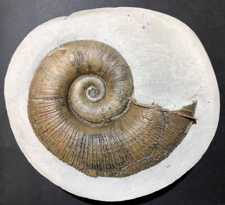
| Trilacinoceras norvegicum |
A lovely example of
Trilacinoceras norvegicum (Sweet, 1958), a nektonic carnivorous cephalopod from Ordovician outcrops on Helgö Island, Hovindsholm, Helgøya, Lake Mjosa, Norway.
This has been a site of human habitation for more than 5,000 years. Vikings, kings, traders, farmers — and geologists have walked these fields.
To give that timeframe a bit of context, that's about the age of Skara Brae, the Neolithic settlement in Orkney, Scotland — and older than Stonehenge which clocks in at 3000 BC to 2000 BC and the Great Pyramids — built around 2560 BC.
For my friend, Gale Bishop, that's about 469 km west or a good 7-hour drive from your ancestral home in Ask, just north of Bergen and just south of Knarvik where many of my relatives live — Hei du!
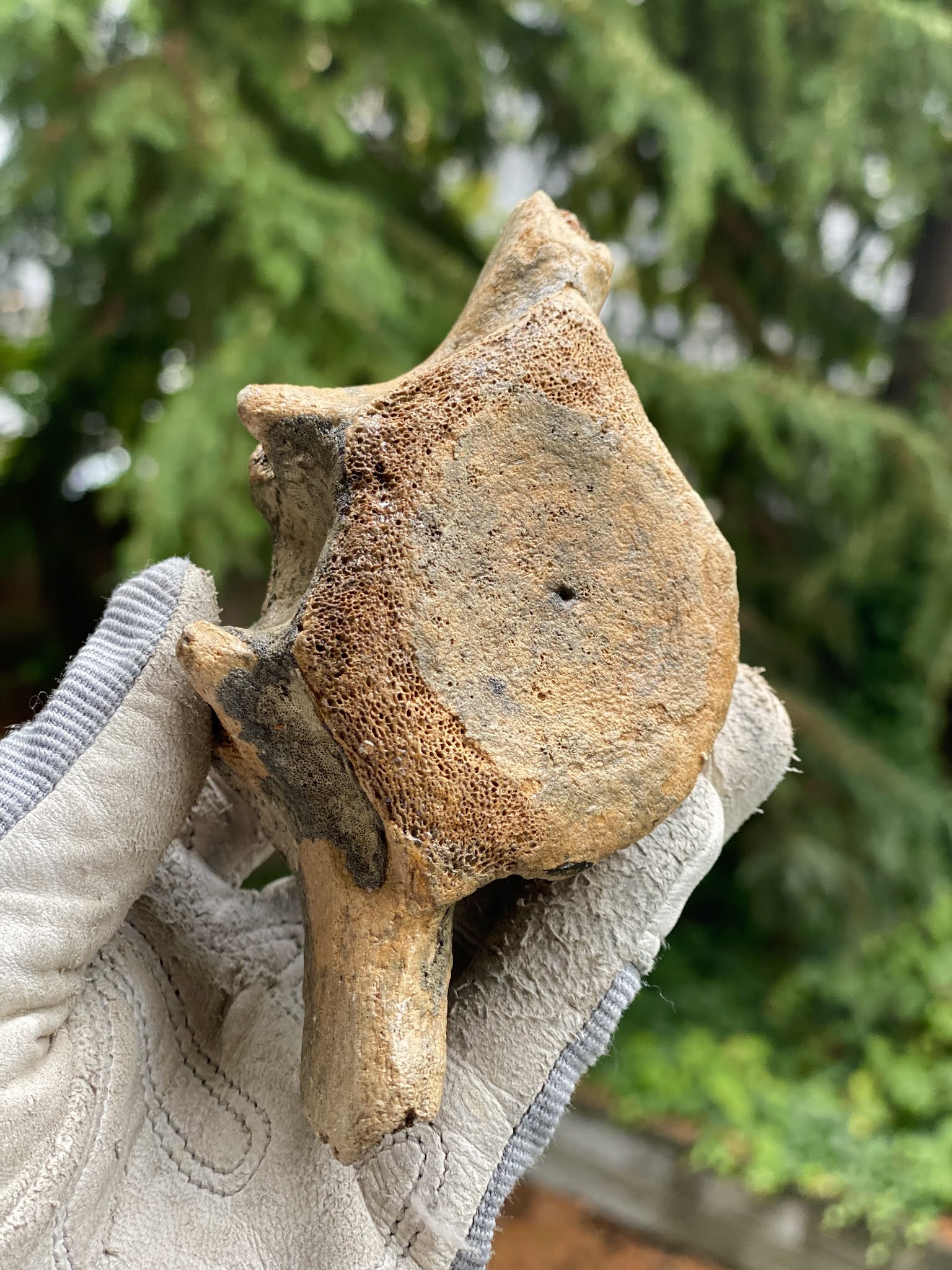
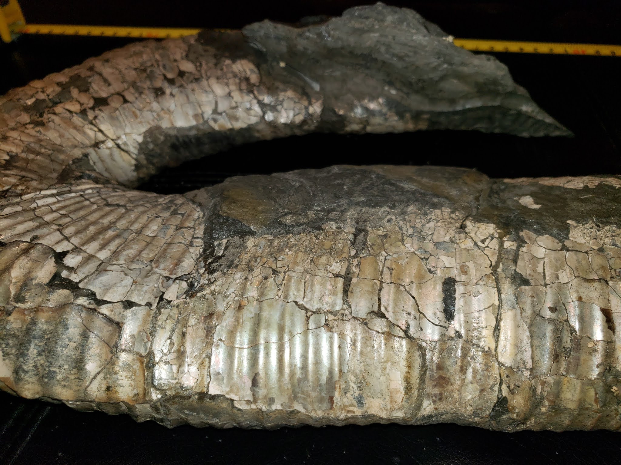
The fossils found here are part of the Engervik Member, Elnes Formation, Aseri, and date back to the Middle Ordovician, 463.5 - 460.9 million years ago. W. C. Sweet did fossil fieldwork here in the 1950s and published a paper on the Middle Ordovician of the Oslo Region, Norway 10. Nautiloid Cephalopods. Norsk Geologisk Tidsskrift 38:1-178.
Deservedly, Sweetoceras boreale is named for him and is one of the most delightful species names of all time. In the 1960s, Yochelson picked up where Sweet left off, continuing the survey of the Middle Ordovician of the Oslo region. I chose this Trilacinoceras for a holiday post because their curly tops remind me of a wee Norwegian gnome, or Nisse from the Norse niðsi, a dear little relative. My Swedish relatives call them Tomte, a throwback to Saint Birgitta of Sweden in the 1300s.
Helgøya is an island in Mjøsa located in the Ringsaker municipality of Hedmark county, Norway. It was formerly a part of the Nes municipality.
Long before that, it was the ruling centre for the Kings in Hedmark, where bold men and women held great blót celebrations to Odin and planned raids and expansion into Europe and Russia — roughly A.D. 793 — the beginning of the Viking Age.
Today, it is lush and green and easy to explore — or fish. Mjøsa is Norway's largest lake, as well as one of the deepest lakes in Norway and in Europe.
Battles have been fought on its waters and its depths hold interesting archaeological and paleontological secrets. They also hold a goodly amount of large and tasty trout, pike, perch, burbot and graylings.
Helgøya is the largest freshwater island in Norway at 18.3 km². The island is delightful to explore and home to 32 farms. One of the most beautiful of these is the Hovinsholm manor. You can visit the farm in both summer and winter — both equally beautiful — and enjoy a café, workshop or their Christmas market. They have lush gardens and some very friendly horses you can pet — or spoil with apples, as you do. The property is massive at 2012 acres, divided into grain, potatoes and forest. It has been home to kings and court. It was a monastery in the Middle Ages from the 5th to the 15th century. Today, Tolle Hoel Slotnæs and his wife, Charlotte Holberg Sveinsen own and run the manor with their three daughters.
 |
| Hovinsholm, Helgøya, Lake Mjosa, Norway |
Helgøya means
holy island, in Norwegian. There is a lovely double meaning here and such layered history. The manor, in its various iterations, has been on this site since the 1500s. They had their own Christian manor church until 1612.
On the southern tip of the island, there is an old pagan temple to the Norse Gods, Thor, Frigg, Loki, Hod, Heimdall, Tyr, and Baldur.
Here, farmers of the area would gather at four blót sacrifices a year that followed the seasons — one for each of the winter solstice, spring equinox, summer solstice and autumn equinox. Animals would be sacrificed, their blood splattered on altars, walls and folk around them. Toasts were made. The first was in honour of Thor or Odin, “to the king and victory.”
Odin, although nominally chief of the gods, was more the god of aristocrats. If a king were toasting, particularly a Danish King, it would be for Odin. If you look at place names in Scandinavia, you'll see him conspicuously absent in favour of Thor, the god of the common man.
When the farmers at Helgøya were shouting
Skål, it was likely for Thor. The toasting and drinking continued with cups emptied for Njörd and Freyr and Freyja in the hope of securing a prosperous future.
Finally, personal pledges (and beer-soaked boasts) would be made to undertake great exploits, Valknut — to die well in battle — and finally to kinsmen laid to rest now drinking with the gods in Valhalla. Weapons, jewellery and tools were thrown into the lake as offerings.
If they were gathering for Jol (Old Norse), Jul (Norwegian) or the Yule blót, they'd also make a large sun wheel (picture a circle with a cross in the middle), carve it up with runes, set it on fire and roll it down a hill.
It was quite a celebration with the festivities going on for three days and nights. With the formalities over, people did as people do — drink, sing, boast, play games and find someone to bed down with — Gods be good.
Thor and Odin are still going strong nearly 1,000 years after the end of the Viking Age. You'd think that the old Nordic religion — the belief in the Norse gods — disappeared with the introduction of Christianity. That is not the case. There are still folk in Denmark (Odin-lovers) and Norway (Thor's their guy) who follow the old Norse religion and worship its ancient gods — right down to the splatter.
If you visit Norway at Christmas, Jul (Yule), you'll find much more of the pagan than the Christian in the festivities. King Haakon, old Haakon the Good, Hákon Góði or Håkon den Gode, moved the Winter Solstice or Yule, Jul, Jol blót over to match up with the Christian holiday on December 25th in his attempts to introduce Christianity in the 10th century. Both traditions are still celebrated but without an overtly religious tone.
Old traditions run deep, animals are still sacrificed (but without all the splatter), bread is baked, houses cleaned, beer is abundant and fires warmth the hearth.
After all the drinking, toasting and feasting at the Jul blót, leftover food was not cleaned up but left overnight for the little relatives. Though shy, Nisse like a good feast and failing to offer them their tithe brings ill-fortune.
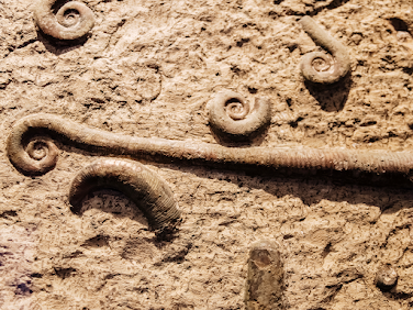
But we started this journey together admiring a lovely (and oddly festive) Ordovician cephalopod. Go on, picture him in red and white with a little beard. If you fancy a visit to the Ordovician outcrops, you can find them at Nes-Hamar, Norway. 60.0° N, 11.2° E: paleo-coordinates 33.7° S, 10.3° W. Look for gastropods (five known species) and cephalopods (at least 15 species).
If you'd like to visit the burial mound of Haakon the Good, you'll want to head to Seim, Hordaland, about 10 km north of Knarvik. Good 'ol Haakon may have tried to bring Christianity to Norway but he died full Viking — taking an arrow at the Battle of Fitjar. Many of my rellies live in Knarvik.
We have enjoyed many a sunny afternoon feasting at the Håkonarspelet summer festivals and exploring Haakon's burial mound at Håkonhaugen in Seim.
If you're more of the manor type, you can stop by Hovinsholm gård, Helgøyvegen 850, 2350 Nes på Hedmarken, Norway.
If you're curious and want to see the farmstead, head on over to: https://www.skafferiet.no/about.
If you need to square things up with Odin, you're on your own.
E. L. Yochelson. 1963. The Middle Ordovician of the Oslo Region, Norway. 15. Monoplacophora and Gastropoda. Norsk Geologisk Tidsskrift 43 (2):133-213.