Lytoceras sp. Photo: Craig Chivers |
The concretion prior to prep |
Lytoceras sp. Photo: Craig Chivers |
The concretion prior to prep |
Both bear families descend from a common ancestor, Ursavus, a bear-dog the size of a raccoon who lived more than 20 million years ago. Seems an implausible lineage given the size of their very large descendants.
An average Grizzly weighs in around 800 lbs (363 kg), but a recent find in Alaska tops the charts at 1600 lbs (726 kg). This mighty beast stood 12' 6' high at the shoulder, 14' to the top of his head and is one of the largest grizzlies ever recorded — a na̱ndzi.
Adult bears tend to live solo except during mating season. Those looking for love congregate from May to July in the hopes of finding a mate. Through adaptation to shifting seasons, the females' reproductive system delays the implantation of fertilized eggs — blastocysts —until November or December to ensure her healthy pups arrive during hibernation. If food resources were slim that year, the newly formed embryo will not catch or attach itself to her uterine wall and she'll try again next year.
Females reach mating maturity at 4-5 years of age. They give birth to a single or up to four cubs (though usually just two) in January or February. The newborn cubs are cute little nuggets — tiny, hairless, and helpless — weighing in at 2-3 kilograms or 4-8 pounds. They feast on their mother’s nutrient-dense milk for the first two months of life. The cubs stay with their mamma for 18 months or more. Once fully grown, they can run 56 km an hour, are good at climbing trees and swimming and live 20-25 years in the wild.
First Nation Lore and Language
In the Kwak'wala language of the Kwakiutl First Nations of the Pacific Northwest — or Kwakwaka'wakw, speakers of Kwak'wala — a Grizzly bear is known as na̱n.
The ornamental carved Grizzly bear headdress was worn by the comic Dluwalakha Grizzly Bear Dancers, Once more from Heaven, in the Grizzly Bear Dance or Gaga̱lalał, is known as na̱ng̱a̱mł.
The Dluwalakha dancers were given supernatural treasures or dloogwi which they passed down from generation to generation.
In the Hamat'sa Grizzly bear dance, Nanes Bakbakwalanooksiwae, no mask was worn. Instead, the dancers painted their faces red and wore a costume of bearskin or t̓ła̱ntsa̱m and long wooden claws attached to their hands. You can imagine how impressive that sight is lit by the warm flickering flames of firelight during a Winter Dance ceremony.
Smoke of the World / Speaking of the Ancestors — Na̱wiła
Kwaguʼł Winter Dancers — Qagyuhl |
To tell stories of the ancestors is na̱wiła. Each of these ancestors took off their masks to become human and founded the many groups that are now bound together by language and culture as Kwakwaka’wakw.
The four First Nations who collectively make up the Kwakiutl are the Kwakiutl (Kwágu7lh), K’umk’utis/Komkiutis, Kwixa/Kweeha (Komoyoi) and Walas Kwakiutl (Lakwilala) First Nations.
There is likely blood of the Lawit’sis in there, too, as they inhabited the village site at Tsax̱is, Fort Rupert before the Kwakiutl made it a permanent home.
Not all Kwakwaka'wakw dance the Gaga̱lalał, but their ancestors likely attended feasts where the great bear was celebrated. To speak or tell stories of the ancestors is na̱wiła — and Grizzly bear as an ancestor is na̱n helus.
Visiting British Columbia's Great Bears
If you are interested in viewing British Columbia's Great Bears, do check out Indigenous Tourism BC's wonderfully informative website and the culturally-rich wildlife experiences on offer.You will discover travel ideas and resources to plan your next soul-powered adventure. To learn more about British Columbia's Great Bears and the continuing legacy of First Nation stewardship, visit:
Indigenous Tourism BC: https://www.indigenousbc.com
Great Bear Lodge has been offering tours to view the majestic animals of the Pacific Northwest. They keep both the guests and the animals' comfort and protection in mind. I highly recommend their hospitality and expertise. To see their offerings, visit: www.greatbeartours.com
Image: Group of Winter Dancers--Qagyuhl; Curtis, Edward S., 1868-1952, https://lccn.loc.gov/2003652753.
Note: The Qagyuhl in the title of this photograph refers to the First Nation group, not the dancers themselves. I think our dear Edward was trying to spell Kwaguʼł and came as close as he was able. In Kwak'wala, the language of the Kwaguʼł or Kwakwakaʼwakw, speakers of Kwak'wala, the Head Winter Dancer is called t̕seḵa̱me' — and to call someone a really good dancer, you would use ya̱'winux̱w.
Charmingly, when Edward S. Curtis was visiting Tsaxis/T'sakis, he was challenged to a wrestling competition with a Giant Pacific Octopus, Enteroctopus dofleini. George Hunt (1854-1933) had issued the challenge and laughed himself senseless when Edward got himself completely wrapped up in tentacles and was unable to move. Edward was soon untangled and went on to take many more photos of the First Nations of the Pacific Northwest. Things did not go as well for the octopus or ta̱ḵ̕wa. It was later served for dinner or dzaḵwax̱stala, as it seemed calamari was destined for that night's menu.
My Norwegian cousins on my mother's side call them humle. Norway is a wonderful place to be something wild as the wild places have not been disturbed by our hands.
There are an impressive thirty-five species of bumblebee species that call Norway hjem (home), and one, Bombus consobrinus, boasts the longest tongue that they use to feast solely on Monkshood, genus Aconitum, you may know by the name Wolf's-bane.
In the Kwak̓wala language of the Kwakwaka'wakw, speakers of Kwak'wala, and my family in the Pacific Northwest, bumblebees are known as ha̱mdzalat̕si — though I wonder if this is actually the word for a honey bee, Apis mellifera, as ha̱mdzat̕si is the word for a beehive.
I have a special fondness for all bees and look for them both in the garden and in First Nation art.
Bumblebees' habit of rolling around in flowers gives us a sense that these industrious insects are also playful. In First Nation art they provide levity — comic relief along with their cousins the mosquitoes and wasps — as First Nation dancers wear masks made to mimic their round faces, big round eyes and pointy stingers. A bit of artistic license is taken with their forms as each mask may have up to six stingers. The dancers weave amongst the watchful audience and swoop down to playfully give many of the guests a good, albeit gentle, poke.
Honey bees actually do a little dance when they get back to the nest with news of an exciting new place to forage — truly they do. Bumblebees do not do a wee bee dance when they come home pleased with themselves from a successful foraging mission, but they do rush around excitedly, running to and fro to share their excitement. They are social learners, so this behaviour can signal those heading out to join them as they return to the perfect patch of wildflowers.
Bumblebees are quite passive and usually sting in defence of their nest or if they feel threatened. Female bumblebees can sting several times and live on afterwards — unlike honeybees who hold back on their single sting as its barbs hook in once used and their exit shears it off, marking their demise.They are important buzz pollinators both for our food crops and our wildflowers. Their wings beat at 130 times or more per second, literally shaking the pollen off the flowers with their vibration.
And they truly are busy bees, spending their days fully focused on their work. Bumblebees collect and carry pollen and nectar back to the nest which may be as much as 25% to 75% of their body weight.
And they are courteous — as they harvest each flower, they mark them with a particular scent to help others in their group know that the nectar is gone.
The food they bring back to the nest is eaten to keep the hive healthy but is not used to make honey as each new season's queen bees hibernate over the winter and emerge reinvigorated to seek a new hive each Spring. She will choose a new site, primarily underground depending on the bumblebee species, and then set to work building wax cells for each of her fertilised eggs.
Bumblebees are quite hardy. The plentiful hairs on their bodies are coated in oils that provide them with natural waterproofing. They can also generate more heat than their smaller, slender honey bee cousins, so they remain productive workers in cooler weather.
We see the first bumblebees arise in the fossil record 100 million years ago and diversify alongside the earliest flowering plants. Their evolution is an entangled dance with the pollen and varied array of flowers that colour our world.We have found many wonderful examples within the fossil record, including a rather famous Eocene fossil bee found by a dear friend and naturalist who has left this Earth, Rene Savenye.
His namesake, H. Savenyei, is a lovely fossil halictine bee from Early Eocene deposits near Quilchena, British Columbia — and the first bee body-fossil known from the Okanagan Highlands — and indeed from Canada.
It is a fitting homage, as bees symbolize honesty, playfulness and willingness to serve the community in our local First Nation lore and around the world — something Rene did his whole life.
Nootka Fossil Field Trip. Photo: John Fam |
Just off the shores of Vancouver Island, east of Gold River and south of Tahsis is the picturesque and remote Nootka Island.
This is the land of the proud and thriving Nuu-chah-nulth First Nations who have lived here always.
Always is a long time, but we know from oral history and archaeological evidence that the Mowachaht and Muchalaht peoples lived here, along with many others, for many thousands of years — a time span much like always.
While we know this area as Nootka Sound and the land we explore for fossils as Nootka Island, these names stem from a wee misunderstanding.
Just four years after the 1774 visit by Spanish explorer Juan Pérez — and only a year before the Spanish established a military and fur trading post on the site of Yuquot — the Nuu-chah-nulth met the Englishman, James Cook.
Captain Cook sailed to the village of Yuquot just west of Vancouver Island to a very warm welcome. He and his crew stayed on for a month of storytelling, trading and ship repairs. Friendly, but not familiar with the local language, he misunderstood the name for both the people and land to be Nootka. In actual fact, Nootka means, go around, go around.
Two hundred years later, in 1978, the Nuu-chah-nulth chose the collective term Nuu-chah-nulth — nuučaan̓uł, meaning all along the mountains and sea or along the outside (of Vancouver Island) — to describe themselves.It is a term now used to describe several First Nations people living along western Vancouver Island, British Columbia.
It is similar in a way to the use of the United Kingdom to refer to the lands of England, Scotland and Wales — though using United Kingdom-ers would be odd. Bless the Nuu-chah-nulth for their grace in choosing this collective name.
An older term for this group of peoples was Aht, which means people in their language and is a component in all the names of their subgroups, and of beautiful locations in this region — Yuquot, Mowachaht, Kyuquot, Opitsaht. While collectively, they are the Nuu-chah-nulth, be interested in their more regional name should you meet them.
But why does it matter? If you have ever mistakenly referred to someone from New Zealand as an Aussie or someone from Scotland as English, you have likely been schooled by an immediate — sometimes forceful, sometimes gracious — correction of your ways. The best answer to why it matters is because it matters.
Each of the subgroups of the Nuu-chah-nulth viewed their lands and seasonal migration within them (though not outside of them) from a viewpoint of inside and outside. Kla'a or outside is the term for their coastal environment and hilstis for their inside or inland environment.
It is to their kla'a that I was most keen to explore. Here, the lovely Late Eocene and Early Miocene exposures offer up fossil crab, mostly the species Raninid, along with fossil gastropods, bivalves, pine cones and spectacularly — a singular seed pod. These wonderfully preserved specimens are found in concretion along the foreshore where time and tide erode them out each year.
Five years after Spanish explorer Juan Pérez's first visit, the Spanish built and maintained a military post at Yuquot where they tore down the local houses to build their own structures and set up what would become a significant fur trade port for the Northwest Coast — with the local Chief Maquinna's blessing and his warriors acting as middlemen to other First Nations.
Following reports of Cook's exploration British traders began to use the harbour of Nootka (Friendly Cove) as a base for a promising trade with China in sea-otter pelts but became embroiled with the Spanish who claimed (albeit erroneously) sovereignty over the Pacific Ocean.
Dan Bowen searching an outcrop. Photo: John Fam |
George Vancouver on his subsequent exploration in 1792 circumnavigated the island and charted much of the coastline. His meeting with the Spanish captain Bodega y Quadra at Nootka was friendly but did not accomplish the expected formal ceding of land by the Spanish to the British.
It resulted however in his vain naming the island "Vancouver and Quadra." The Spanish captain's name was later dropped and given to the island on the east side of Discovery Strait. Again, another vain and unearned title that persists to this day.
Early settlement of the island was carried out mainly under the sponsorship of the Hudson's Bay Company whose lease from the Crown amounted to 7 shillings per year — that's roughly equal to £100.00 or $174 CDN today. Victoria, the capital of British Columbia, was founded in 1843 as Fort Victoria on the southern end of Vancouver Island by the Hudson's Bay Company's Chief Factor, Sir James Douglas.
With Douglas's help, the Hudson's Bay Company established Fort Rupert on the north end of Vancouver Island in 1849. Both became centres of fur trade and trade between First Nations and solidified the Hudson's Bay Company's trading monopoly in the Pacific Northwest.The settlement of Fort Victoria on the southern tip of Vancouver Island — handily south of the 49th parallel — greatly aided British negotiators to retain all of the islands when a line was finally set to mark the northern boundary of the United States with the signing of the Oregon Boundary Treaty of 1846. Vancouver Island became a separate British colony in 1858. British Columbia, exclusive of the island, was made a colony in 1858 and in 1866 the two colonies were joined into one — becoming a province of Canada in 1871 with Victoria as the capital.
Dan Bowen, Chair of the Vancouver Island Palaeontological Society (VIPS) did a truly splendid talk on the Fossils of Nootka Sound. With his permission, I have uploaded the talk to the ARCHEA YouTube Channel for all to enjoy. Do take a boo, he is a great presenter. Dan also graciously provided the photos you see here. The last of the photos you see here is from a VIPS Nootka Fossil Field Trip. We head out each year as the people, scenery, wildlife and fossils are amazing. Photo: John Fam, Vice-Chair, Vancouver Paleontological Society (VanPS).
Know Before You Go — Nootka Trail
The Nootka Trail passes through the traditional lands of the Mowachaht/Muchalat First Nations who have lived here since always. They share this area with humpback and Gray whales, orcas, seals, sea lions, black bears, wolves, cougars, eagles, ravens, sea birds, river otters, insects and the many colourful intertidal creatures that you'll want to photograph.
This is a remote West Coast wilderness experience. Getting to Nootka Island requires some planning as you'll need to take a seaplane or water taxi to reach the trailhead. The trail takes 4-8 days to cover the 37 km year-round hike. The peak season is July to September. Permits are not required for the hike.
Access via: Air Nootka floatplane, water taxi, or MV Uchuck III
Fergusonites hendersonae (Longridge, 2008) |
While rare today, these are British Columbia’s only native oyster.
Had you been dining on their brethren in the 1800s or earlier, it would have been this species you were consuming. Middens from Port Hardy to California are built from Ostrea lurida.
These wonderful invertebrates bare their souls with every bite. Have they lived in cold water, deep beneath the sea, protected from the sun's rays and heat? Are they the rough and tumble beach denizens whose thick shells tell us of a life spent withstanding the relentless pounding of the sea? Is the oyster in your mouth thin and slimy having just done the nasty—spurred by the warming waters of Spring?
Is this oyster a local or was it shipped to your current local and, if asked, would greet you with "Kon'nichiwa?" Not if the beauty on your plate is indeed Ostrea lurida.
Oyster in Kwak'wala is t̕łox̱t̕łox̱ |
The area is home to the Nuu-chah-nulth First Nations who have consumed this species boiled or steamed for thousands of years. Here these ancient oysters not only survive but thrive — building reefs and providing habitat for crab, anemones and small marine animals.
Oysters are in the family Ostreidae — the true oysters. Their lineage evolved in the Early Triassic — 251 - 247 million years ago.
In the Kwak̓wala language of the Kwakiutl or Kwakwaka'wakw, speakers of Kwak'wala, of the Pacific Northwest and my family, an oyster is known as t̕łox̱t̕łox̱.
I am curious to learn if any of the Nuu-chah-nulth have a different word for an oyster. If you happen to know, I would be grateful to learn.
Titanites occidentalis, Fernie Ammonite |
This beauty is the remains of a carnivorous cephalopod within the family Dorsoplanitidae that lived and died in a shallow sea some 150 million years ago.
If you would like to get off the beaten track and hike up to see this ancient beauty, you will want to head to the town of Fernie in British Columbia close to the Alberta border.
This is the traditional territory of the the Yaq̓it ʔa·knuqⱡi ‘it First Nation who have lived here since time immemorial. There was some active logging along the hillside in 2021, so if you are looking at older directions on how to get to the site be mindful that many of the trailheads have been altered and a fair bit of bushwhacking will be necessary to get to the fossil site proper. That being said, the loggers from CanWel may have clear-cut large sections of the hillside but they did give the ammonite a wide berth and have left it intact.
Wildsight, a non-profit environmental group out of the Kimberly Cranbrook area has been trying to gain grant funding to open up the site as an educational hike with educational signage for folks visiting the Fernie area. It is likely the province of British Columbia would top up those funds if they are able to place the ammonite under the Heritage Conservation Act. CanWel would remain the owners of the land but the province could assume the liability for those visiting this iconic piece of British Columbia's palaeontological history.
Driving to the trail base is along an easy access road just east of town along Fernie Coal Road. There are some nice exposures of Cretaceous plant material on the north side (left-hand side) of the road as you head from Fernie towards Coal Creek. I recently drove up to Fernie to look at Cretaceous plant material and locate the access point to the now infamous Late Jurassic (Tithonian) Titanites (S.S. Buckman, 1921) site. While the drive out of town is on an easy, well-maintained road, the slog up to the ammonite site is often a wet, steep push. This time of year, it is buried in a blanket of crisp, white snow.
Fernie, British Columbia, Canada |
Titanites occidentalis, the Western Giant, is the second known specimen of this extinct fossil species.
The first was discovered in 1947 in nearby Coal Creek by a British Columbia Geophysical Society mapping team. When they first discovered this marine fossil high up on the hillside, they could not believe their eyes — both because it is clearly marine at the top of a mountain and the sheer size of this ancient beauty.
In the summer of 1947, on a warm summer's day, a field crew was mapping coal outcrops for the BC Geological Survey (GSC) east of Fernie. One of the students reported finding “a fossil truck tire.” Fair enough. The similarity of size and optics are pretty close to your average Goodridge.
A few years later, GSC Paleontologist Hans Frebold described and named the fossil Titanites occidentalis after the large Jurassic ammonites from Dorset, England. The name comes from Greek mythology. Tithonus, as you may recall, was the Prince of Troy. He fell in love with Eos, the Greek Goddess of the Dawn. Eos begged Zeus to make her mortal lover immortal. Zeus granted her wish but did not grant Tithonus eternal youth. He did indeed live forever — ageing hideously. Ah, Zeus, you old trickster. It is a clever play on time placement. Dawn is the beginning of the day and the Tithonian being the latest age of the Late Jurassic. Clever Hans!
HIKING TO THE FERNIE AMMONITE
From the town of Fernie, British Columbia, head east along Coal Creek Road towards Coal Creek. The site is 3.81 km from the base of Coal Creek Road to the trailhead as the crow flies. I have mapped it here for you in yellow and added the wee purple GPS marker for the ammonite site proper. There is a nice, dark grey to black roadcut exposure of Cretaceous plants on the north side of the dirt road that is your cue to pull over and park.
You access what is left of the trailhead on the south side of the road. You will need to cross the creek to begin your ascent. There is no easy way across the creek and you'll want to tackle this one with a friend when the water level is low.
The beginning of the trail is not clear but a bit of searching will reveal the trailhead with its telltale signs of previous hikers. This is a moderate 6.3-kilometre hike up & back bushwhacking through scrub and fallen trees. Heading up, you will make about a 246-metre elevation gain. You will likely not have a cellular signal up here but if you download the Google Map to your mobile, you will have GPS to guide you. The area has been recently logged so much of the original trail has been destroyed. There may now be easier vehicle access up the logging roads but I have not driven them since the logging and new road construction.
If you are coming in from out of town, the closest airport is Cranbrook. Then it is about an hour and change to Fernie and another 15-minutes or so to park near the site.
You will want to leave your hammers with your vehicle (no need to carry the weight and this lovely should never be struck with anything more than a raindrop) as this site is best enjoyed with a camera.This is a site you will want to wear hiking boots to access. Know that these will get wet as you cross the creek.
If you would like to see the ammonite but are not keen on the hike, a cast has been made by fossil preparator Rod Bartlett is on display at the Courtenay Museum in Courtenay, Vancouver Island, Canada.
Respect for the Land / Leave No Trace
As your feet move up the hillside, you can imagine this land 10,000 years ago, rising above great glaciers. Where footfalls trace the steps of those that came before you. This land has been home to the Yaq̓it ʔa·knuqⱡi ‘it First Nation and Ktunaxa or Kukin ʔamakis First Nations whose oral history have them living here since time immemorial. Like them, take only what you need and no more than the land offers — packing out anything that you packed in.
Fernie Ammonite Palaeo Coordinates: 49°29'04"N 115°00'49"W
This material is very important as it greatly expands our understanding of the fauna and ranges of ammonites currently included in the North American regional ammonite zonation.
I had the very great honour of having the fellow below, Fergusonites hendersonae, a new species of nektonic carnivorous ammonite, named after me by palaeontologist Louse Longridge from the University of British Columbia.
I'd met Louise as an undergrad and was pleased as punch to hear that she would be continuing the research by Dr. Howard Tipper, the authority on this area of the Chilcotins and Haida Gwaii — which he dearly loved.
"Tip" was a renowned Jurassic ammonite palaeontologist and an excellent regional mapper who mapped large areas of the Cordillera. He made significant contributions to Jurassic paleobiogeography and taxonomy in collaboration with Dr. Paul Smith, Head of Earth and Ocean Science at the University of British Columbia.
Tip’s regional mapping within BC has withstood the test of time and for many areas became the regions' base maps for future studies. The scope of Tip’s understanding of Cordilleran geology and Jurassic palaeontology will likely never be matched. He passed away on April 21, 2005. His humour, knowledge and leadership will be sorely missed.
Fergusonites hendersonae |
Both Dan Bowen and John Fam were instrumental in planning those expeditions and each of them benefited greatly from the knowledge of Dr. Howard Tipper.
If not for Tipper's early work in the region, our shared understanding and much of what was accomplished in his last years and after his passing would not have been possible.
Over the course of three field seasons, we endured elevation sickness, rain, snow, grizzly bears and very chilly nights — we were sleeping right next to a glacier at one point — but were rewarded by the enthusiastic crew, helicopter rides — which really cut down the hiking time — excellent specimens including three new species of ammonites, along with a high-spired gastropod and lobster claw that have yet to be written up. This area of the world is wonderful to hike and explore — stunningly beautiful country. We were also blessed with access as the area is closed to all fossil collecting except with a permit.
This fauna understanding helps us to understand the correlations between different areas: (1) the Mineralense and Rursicostatum zones are present in Taseko Lakes and can be readily correlated with contemporaneous strata elsewhere in North America; (2) the Mineralense and Rursicostatum zones of North America are broadly equivalent to the Canadensis Zone and probably the Arcuatum horizon of the South American succession; (3) broad correlations are possible with middle–late Hettangian and earliest Sinemurian taxa in New Zealand; (4) the Mineralense and Rursicostatum zones are broadly equivalent to the circum‐Mediterranean Marmoreum Zone; (5) the Mineralense Zone and the lower to middle portion of the Rursicostatum Zone are probably equivalent to the Complanata Subzone whereas the upper portion of the Rursicostatum Zone may equate to the Depressa Subzone of the north‐west European succession.
Taseko Lake Area, BC |
Since then, knowledge of eastern Pacific Hettangian ammonite faunas has improved considerably.
Detailed systematic studies have been completed on faunas from localities in other areas of BC, Alberta, Alaska, Oregon, Nevada, Mexico and South America (e.g. Guex 1980, 1995; Imlay 1981; Hillebrandt 1981, 1988, 1990, 1994, 2000a–d; Smith and Tipper 1986; Riccardi et al. 1991; Jakobs and Pálfy 1994; Pálfy et al. 1994, 1999; Taylor 1998; Hall et al. 2000; Taylor and Guex 2002; Hall and Pitaru 2004).
These studies have demonstrated that Early Jurassic eastern Pacific ammonites had strong Tethyan affinities as well as a high degree of endemism (Guex 1980, 1995; Taylor et al. 1984; Smith et al. 1988; Jakobs et al. 1994; Pálfy et al. 1994). Frebold’s early studies were also hampered because they were based on small collections, which limited understanding of the diversity of the fauna and variation within populations. However, recent mapping has greatly improved our understanding of the geology of Taseko Lakes (Schiarizza et al. 1997; Smith et al. 1998; Umhoefer and Tipper 1998) and encouraged further collecting that has dramatically increased the size of the sample.
A study of the ammonite fauna from Taseko Lakes is of interest for several reasons. The data are important for increasing the precision of the late Hettangian portion of the North American Zonation.
Owing to the principally Tethyan or endemic nature of Early Jurassic ammonites in the eastern Pacific, a separate zonation for the Hettangian and Sinemurian of the Western Cordillera of North America has been established by Taylor et al. (2001). Except for information available from the early studies by Frebold (1951, 1967), the only Taseko Lakes taxa included in the North American Zonation of Taylor et al. (2001) were species of Angulaticeras studied by Smith and Tipper (2000).
Since then, Longridge et al. (2006) made significant changes to the zonation of the late Hettangian and early Sinemurian based on a detailed study of the Badouxia fauna from Taseko Lakes (Text‐fig. 2). An additional taxonomic study was recently completed on the late Hettangian ammonite Sunrisites (Longridge et al. 2008) and this information has not yet been included within the zonation.
Hettangian Zonation |
The Taseko Lakes fauna can improve Hettangian correlations within North America as well as between North America and the rest of the world.
North‐west European ammonite successions (e.g. Dean et al. 1961; Mouterde and Corna 1997; Page 2003) are considered the primary standard for Early Jurassic biochronology (Callomon 1984).
In north‐west Europe, the turnover from schlotheimiid dominated faunas in the late Hettangian to arietitid dominated faunas in the early Sinemurian was sharp (e.g. Dean et al. 1961; Bloos 1994; Bloos and Page 2002). In other areas, by contrast, these faunas were not so mutually exclusive and the transition was much more gradual.
This makes correlations between north‐west Europe and other areas difficult (e.g. Bloos 1994; Bloos and Page 2000, 2002). Correlations are further impeded by endemism and provincialism.
The Taseko Lakes fauna addresses these problems because it contains many taxa that are common throughout the eastern Pacific as well as several cosmopolitan taxa that make intercontinental correlation possible. Correlation between North America and other areas is of particular significance in that the interbedded volcanic and fossiliferous marine rocks in North America permit the calibration of geochronological and biochronological time scales (Pálfy et al. 1999, 2000).
This correlation between the late Hettangian fauna in the Taseko Lakes area and contemporaneous faunas in other areas of North America, South America, New Zealand, western and eastern Tethys, and north‐west Europe is of particular interest to me — especially the correlation of the faunal sequences of Nevada, USA.
Reference: PaleoDB 157367 M. Clapham GSC C-208992, Section A 09, Castle Pass Angulata - Jurassic 1 - Canada, Longridge et al. (2008)
L. M. Longridge, P. L. Smith, and H. W. Tipper. 2008. Late Hettangian (Early Jurassic) ammonites from Taseko Lakes, British Columbia, Canada. Palaeontology 51:367-404
PaleoDB taxon number: 297415; Cephalopoda - Ammonoidea - Juraphyllitidae; Fergusonites hendersonae Longridge et al. 2008 (ammonite); Average measurements (in mm): shell width 9.88, shell diameter 28.2; Age range: 201.6 to 196.5 Ma. Locality info: British Columbia, Canada (51.1° N, 123.0° W: paleo coordinates 22.1° N, 66.1° W)
Oligocene Fossil Whale Vertebrae, Olympic Peninsula |
Baby Gray Whale, Eschrichtius robustus, showing his baleen |
Rizwaan Abbas, Palaeoanthropologist |
He is all kinds of awesome. I had the great pleasure of learning more about his work and research this past week on the set of BC's Fossil Bounty.
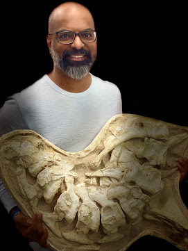
I have shared some of the Behind the Scenes moments with you including Riz holding a rather fetching mosasaur.
Rizwaan ensures that First Nation issues are addressed within multiple levels of government and that the people of the Semiahmoo First Nation always have a seat at the table.
Semiahmoo First Nation (/ˌsɛmiˈɑːmuː/ SEM-ee-AH-moo) is the band government of the Semiahmoo people, a Coast Salish subgroup who inhabited an extensive territory across Washington state, the Strait of Georgia (now known as the Salish Sea) and the Lower Mainland of British Columbia for thousands of years.
The band's main community and offices are located on the 312 acres (1.3 km2) Semiahmoo Indian Reserve which is sandwiched between the boundary of White Rock, British Columbia and the Canada–United States boundary and Peace Arch Provincial Park.
Before 1850, they primarily spent their winters at Drayton Harbour, Birch Bay, Crescent Beach and Semiahmoo Bay. Summers were spent a few kilometres west across the shallow waters of Boundary Bay in what is now known as Tsawwassen—derived from the Halkomelem word sc̓əwaθən, meaning "land facing the sea"— and Point Roberts.
Rizwaan Abbas and Eva Svobodova on set |
The two parties agreed that the 49th parallel would define the boundary between their respective territories, and the small area that incorporates Point Roberts is south of the 49th parallel.
Questions about ceding the territory to the United Kingdom and later to Canada have been raised since its creation but its status has remained unchanged. Returning the land to its original Coast Salish inhabitants has not been an active topic of discussion.
The Coast Salish are ethnically and linguistically related Indigenous peoples of the Pacific Northwest Coast, living in the Canadian province of British Columbia and the U.S. states of Washington and Oregon.
The area around the southern Tsawwassen Peninsula was a favoured fishing spot for several Coast Salish groups, who named the peninsula "q̓ʷulƛ̕əl̕".
The first Europeans to see Point Roberts were members of the 1791 expedition of Francisco de Eliza. The maps produced from Eliza's explorations depicted Point Roberts as "Isla de Cepeda" or "Isla de Zepeda."
In 1792, the British expedition of George Vancouver and the Spanish expedition of Dionisio Alcalá Galiano encountered one another near Point Roberts.
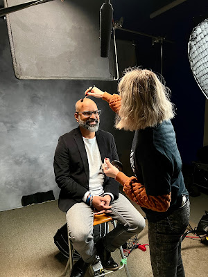
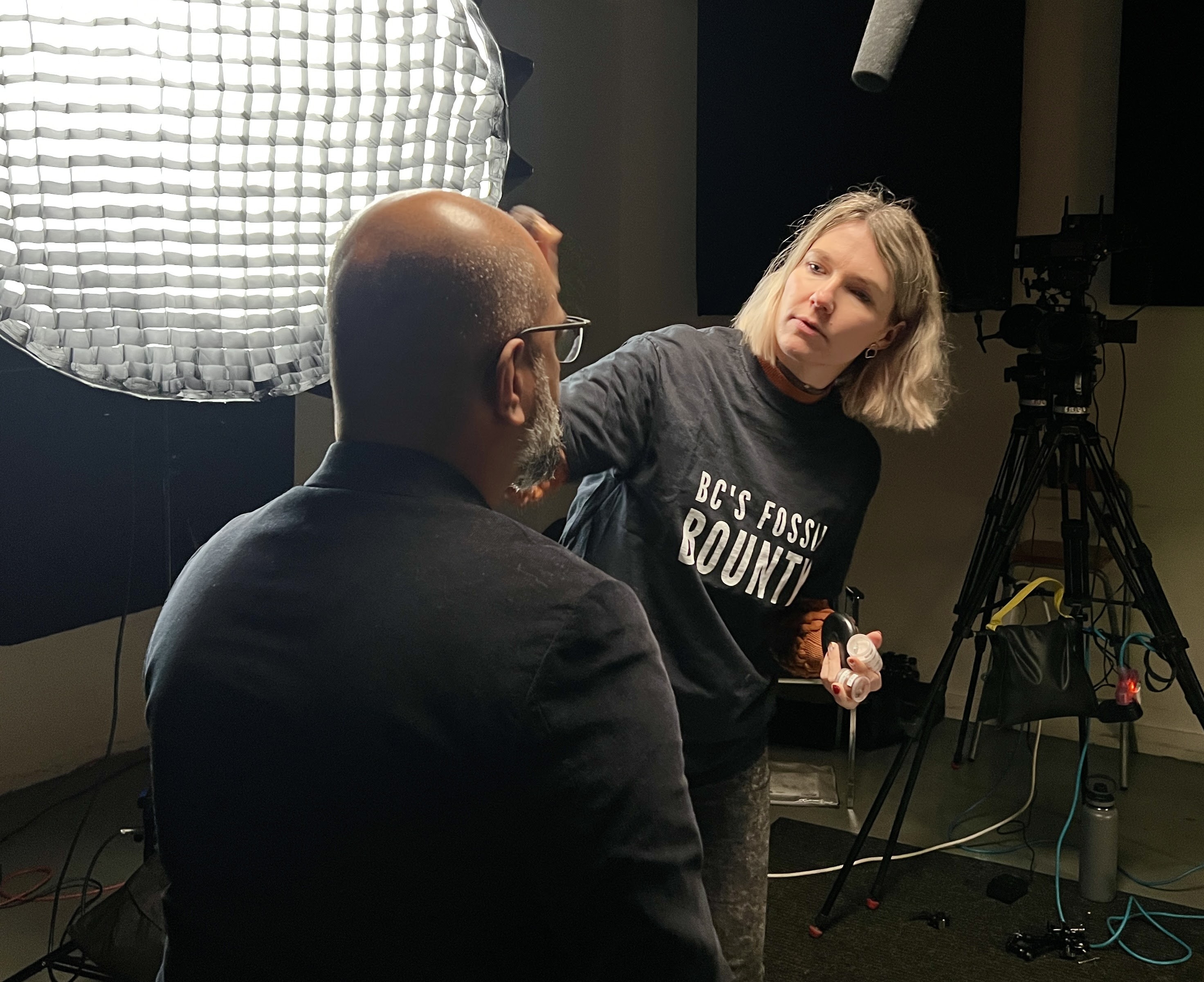
Hair & Makeup Artist Eva Svobodova preps Rizwaan for camera |
They then sailed around Point Roberts and immediately encountered HMS Chatham, the second ship of Vancouver's expedition. The two parties made contact and agreed to share information and work together in mapping the Strait of Georgia.
Point Roberts acquired its present name from Captain Vancouver, who named it after his friend Henry Roberts, who had originally been given command of the expedition.
In 1790, Europeans estimated the Semiahmoo population at 300. By 1854, the band's numbers were reduced to 250 from smallpox and warfare. Contact with Turtle Island’s residents proved devastating. By 1909, when the Canadian Pacific Railway's Spiral Tunnels are opened in British Columbia's Kicking Horse Pass, there were 38 band members in British Columbia.
In 1963, that number dropped to 28 and then just 25 by 1971. Today, there are 98 registered members and 53 members who live on-site. It is a time of resurgence for the nation and Rizwaan’s working to support that endeavour.
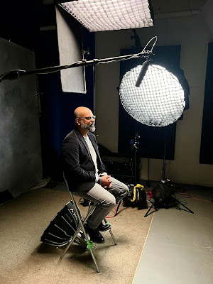
Rizwaan Abbas on the set of BC's Fossil Bounty |
Indo-Fijians are Fijian citizens of Indian descent, including people who trace their ancestry to various regions of the Indian subcontinent. Although they hailed from various regions in the Indian subcontinent, the vast majority of Indo-Fijians trace their origins to the Awadh and Bhojpur regions of the Hindi Belt in northern India.
Many of the Muslim Indo-Fijians also came from Sindh and Balochistan and various other parts of South Asia. Fiji's British colonial rulers brought Indian people to the Colony of Fiji as indentured labourers between 1879 and 1916 to work on Fiji's sugar-cane plantations.
The Indo-Fijian community has a complex history and heritage. Coming to the Fiji Islands as indentured labourers from India between 1879 and 1920, these Girmitiyas were forced to reevaluate their place in the world while simultaneously rebuilding their culture and maintaining their traditional and religious practices in a harsh colonial environment.
Finding no place in India, Girmitiyas created a unique Indo-Fijian culture in the Tropical South Pacific through their shared struggle for respect and acceptance. Some stayed in Fiji and others pushed further afield and found their way to our shores.
Nestled within British Columbia’s population, lies a unique Indo-Fijian culture born from the tropical paradise of the Fiji Islands. Explore the shared history of these Voyager People who left India in search of a future but found hardship in Fiji before finally finding a home.
Piltdown Skull being examined |
It is because of that sharing of lived history that he chose to study archaeology at Simon Fraser University. Archaeology is the study of how people lived in the past—all people, no matter when in the past or where in the world.
Wanting to delve deeper into both archaeology and palaeoanthropology, he continued his studies, this time in Europe. Rizwaan undertook his Masters in Paleoanthropology and Paleolithic Archaeology at the prestigious University College London where he graduated with distinction.
The UCL Institute of Archaeology and Department of Anthropology have considerable staff expertise in the fields of palaeoanthropology and palaeolithic archaeology. Staff and research students are currently involved in field projects as well as museum-based studies in Britain, various parts of Europe, the Middle East, and eastern and southern Africa.
His research focus was on the Geometric and Morphometrics Analysis of Molars. His work led to a remarkable discovery which he published in the Royal Society Open Science in 2016, “New genetic and morphological evidence suggests a single hoaxer created Piltdown man.“’
In 1912, palaeontologist Arthur Smith Woodward and amateur antiquarian and solicitor Charles Dawson announced the discovery of a fossil that supposedly provided a link between apes and humans: Eoanthropus dawsoni meaning Dawson's Dawn Man.
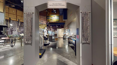
Museum of Surrey - The Indo-Fijians: Surrey's Pocket of Paradise |
The publication generated huge interest from scientists and the general public. Piltdown man's initial celebrity has long been overshadowed by its subsequent infamy as one of the most famous scientific frauds in history.
His re-evaluation of the Piltdown fossils using the latest scientific methods (DNA analyses, high-precision measurements, spectroscopy and virtual anthropology) shows that it is highly likely that a single orang-utan specimen and at least two human specimens were used to create the fake fossils.
The modus operandi was found consistent throughout the assemblage (specimens are stained brown, loaded with gravel fragments and restored using filling materials), linking all specimens from the Piltdown I and Piltdown II sites to a single forger—Charles Dawson.
Whether Dawson acted alone is uncertain, but his hunger for acclaim may have driven him to risk his reputation and misdirect the course of anthropology for decades. The Piltdown hoax stands as a cautionary tale to scientists not to be led by preconceived ideas but to use scientific integrity and rigour in the face of novel discoveries.
Rizwaan's Exhibit at the Museum of Surrey is now closed but you can still take the virtual tour through the link below:
https://www.surrey.ca/arts-culture/museum-of-surrey/exhibitions/indo-fijians-surreys-pocket-of-paradise
You can also read his Chapter about Indo-Fijians printed in the "Social History of South Asians in British Columbia" published by the University of the Fraser Valley (Chapter 9):
https://saclp.southasiancanadianheritage.ca/social-history-book/?fbclid=IwAR0vucbU2T9Ibp3zNCBRYodR35VkE5ilCBelqXG2w7IRG5714GJ8HXMMFfE
Image: Piltdown Man. (2022, December 2). In Wikipedia. https://en.wikipedia.org/wiki/Piltdown_Man. Group portrait of the Piltdown skull being examined. Back row (from left): F. O. Barlow, G. Elliot Smith, Charles Dawson, Arthur Smith Woodward. Front row: A. S. Underwood, Arthur Keith, W. P. Pycraft, and Ray Lankester. Note the portrait of Charles Darwin on the wall. Painting by John Cooke, 1915.
The awesome folk in the Vancouver Paleontological Society and Vancouver Island Palaeontological Society have been collecting with John for many years, some exciting local trips — and some epic trips of a lifetime.
Visiting the fossil outcrops at Tyaughton in the Taseko Lakes area of British Columbia takes months of planning. Remote, dangerous and difficult to reach, these sites are epic and each of those field trips definitely count as trips of a lifetime.
John shares Tales of Tyaughton in his episode of BC's Fossil Bounty.
"For the longest time, a handful of BCPA members have known about the wonderful Triassic-Jurassic fossils of the Tyaughton Creek area. Some of us had been even fortunate to see the spectacular collection of Jurassic ammonites stored in the basement of the Geological Survey of Canada.
I still remember purchasing a copy of Hettangian Ammonoid Faunas of the Taseko Lakes Area by Hans Frebold and wondering if I would even get a chance to visit such a remote locality. If you picture a squid living inside a sea shell floating and hunting in the ocean, these were the ancient creatures we’d be looking for.
We had heard so many stories that this site was becoming somewhat legendary in our minds. Thus, I made it a personal goal of mine to visit the remote fossil beds.
I began researching all possible sources related to Tyaughton Creek. I dug up many old GSC reports by Hans Frebold, Howard Tipper and George Jeletzky along with more recent material by Paul-Smith and his grad students.
All this literature was very helpful in understanding not only the fossil localities but also the complex geology of the region. I also paid a couple of visits to Dr. Howard Tipper of Geological Survey of Canada.
Dr. Tipper was very supportive and helpful in providing valuable information regarding the fossil sites. He also shared with me his extensive knowledge of Jurassic palaeontology.
Armed with this information, I met up with Heidi Henderson, then Chair of the Vancouver Palaeontological Society, who you’ll know as the Fossil Huntress, to plan the first of four expeditions.We had to figure out how to access such a rugged and remote locality. The fossil beds are 16 km from the nearest logging road, several hundred kilometres from Vancouver and 7,500 feet above sea level.
We would be sharing territory with a healthy Grizzly bear population and likely be a food source for the not as large but equally daunting horsefly population.
We were keen to access this elusive site, but hiking in 16 km and gaining about a thousand feet or more of elevation would be a challenge. Hiking back out with 50 kg of rock would be impossible.
We finally decided that it would be best that we fly in by helicopter. That, too, provided its own challenges. In the end, we did four trips over many field seasons.
We met many Grizzly bears, horseflies, we were snowed in but came away with many wonderful fossils including new species. The undergrad we brought on the first trip did her PhD over that time and now teaches at the University of British Columbia."