|
| Dan Bowen, Chair, VIPS, Trent River |
The Pacific Plate is an oceanic tectonic plate that lies beneath the Pacific Ocean. And it is massive. At 103 million km2 (40 million sq mi), it is the largest tectonic plate and continues to grow fed by volcanic eruptions that piggyback onto its trailing edge.
This relentless expansion pushes the Pacific Plate into the North American Plate. The pressure subducts it beneath our continent where it then melts back into the earth. Plate tectonics are slow but powerful forces.
The island chains that rode the plates across the Pacific smashed into our coastline and slowly built the province of British Columbia. And because each of those islands had a different origin, they create pockets of interesting and diverse geology.
It is these islands that make up the Insular Belt — a physio-geological region on the northwestern North American coast. It consists of three major island groups — and many smaller islands — that stretches from southern British Columbia up into Alaska and the Yukon. These bits of islands on the move arrived from the Late Cretaceous through the Eocene — and continues to this day.
The rocks that form the Insular Superterrane are allochthonous, meaning they are not related to the rest of the North American continent. The rocks we walk over along the Trent River are distinct from those we find throughout the rest of Vancouver Island, Haida Gwaii, the rest of the province of British Columbia and completely foreign to those we find next door in Alberta.
To discover what we do find on the Trent takes only a wee stroll, a bit of digging and time to put all the pieces of the puzzle together. The first geological forays to Vancouver Island were to look for coal deposits, the profitable remains of ancient forests that could be burned to the power industry.

We know from their work that by 85 million years ago, the Insular Superterrane had made its way to what is now British Columbia.
The lands were forested much as they are now but by extinct genera and families. The fossil remains of trees similar to oak, poplar, maple and ash can be found along the Trent and Vancouver Island. We also see the lovely remains of flowering plants such as Cupanities crenularis, figs and breadfruit.
Heading up the river, you come to a delineation zone that clearly marks the contact between the dark grey marine shales and mudstones of the Haslam Formation where they meet the sandstones of the Comox Formation. Fossilized material is less abundant in the Comox sandstones but still contains some interesting specimens. Here you begin to see fossilized wood and identifiable fossil plant material.
Further upstream, there is a small tributary, Idle Creek, where you can find more of this terrestrial material in the sandy shales. As you walk up, you see identifiable fossil plants beneath your feet and jungle-like, overgrown moss-covered, snarly trees all around you.
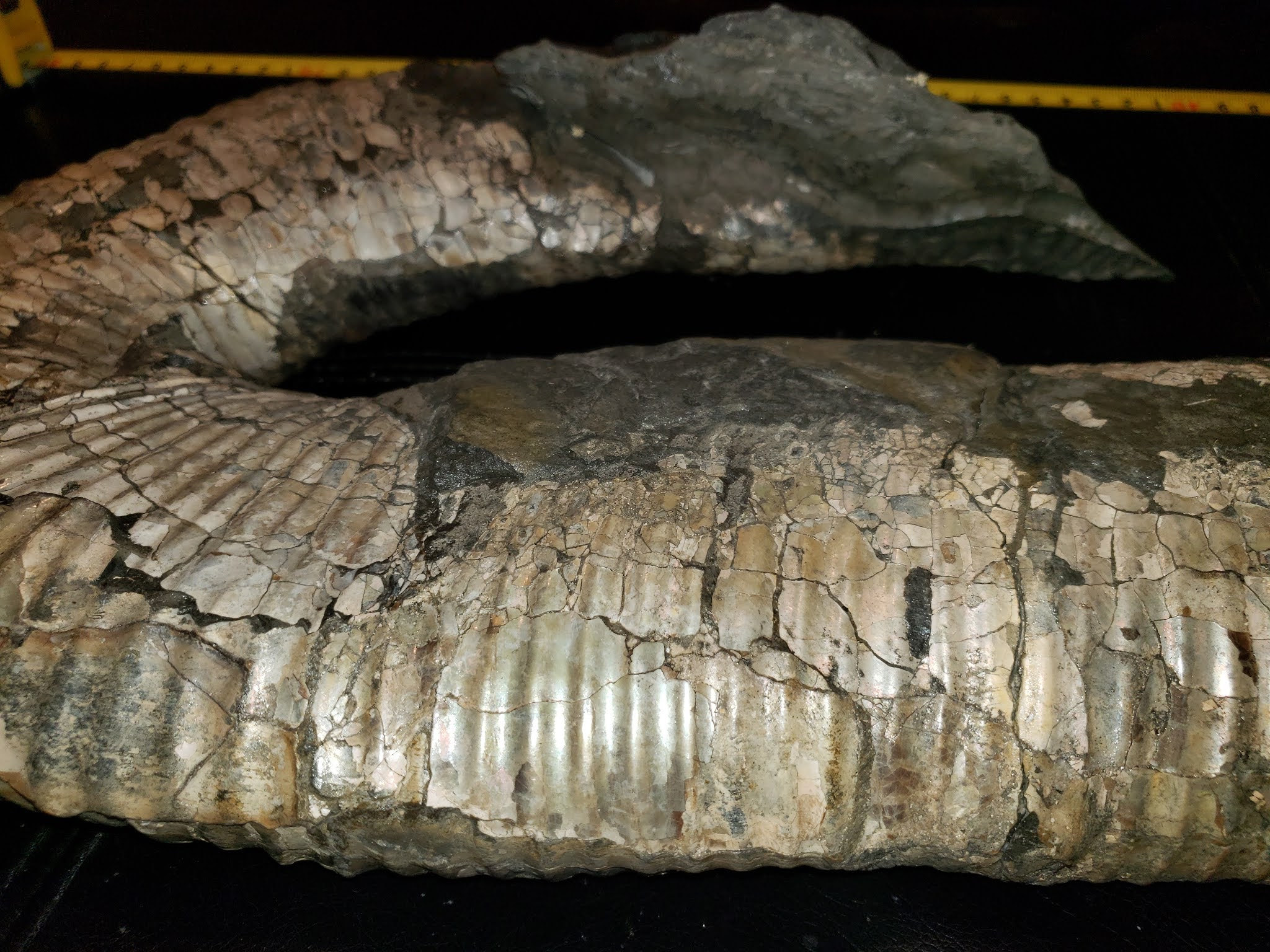
Walking west from the Trent River Falls at the bottom, you pass the infamous Ammonite Alley, where you can find Mesopuzosia sp. and Kitchinites sp. of the Upper Cretaceous (Santonian), Haslam Formation. Minding the slippery green algae covering some of the river rocks, you can see the first of the Polytychoceras vancouverense zone.
Continuing west, you reach the first of two fossil turtle sites on the river — amazingly, one terrestrial and one marine. If you continue, you come to the Inland Island Highway.
The Trent River has yielded some very interesting marine specimens, and significant terrestrial finds. We have found a wonderful terrestrial helochelydrid turtle, Naomichelys speciosa, and the caudal vertebrae of a Hadrosauroid dinosaur. Walking down from the Hadrosaur site you come to the site of the fossil ratfish find — one of the ocean's oddest fish.

This robust fellow had exceptionally large eyes and sex organs that dangled enticingly between them. You mock, but there are many ratfish who would differ. While inherently sexy by ratfish standards, this fellow was not particularly tasty to their ancient marine brethren (or humans today) — so not hugely sought after as a food source or prey.
A little further again from the ratfish site we reach the contact of the two Formations. The rocks here have travelled a long way to their current location. With them, we peel away the layers of the geologic history of both the Comox Valley and the province of British Columbia.
The Trent River is not far from the Puntledge, a river whose banks have also revealed many wonderful fossil specimens. The Puntledge is also the name used by the K'ómoks First Nation to describe themselves. They have lived here since time immemorial. Along with Puntledge, they refer to themselves as Sahtloot, Sasitla and Ieeksun.
References: Note on the occurrence of the marine turtle Desmatochelys (Reptilia: Chelonioidea) from the Upper Cretaceous of Vancouver Island Elizabeth L. Nicholls Canadian Journal of Earth Sciences (1992) 29 (2): 377–380. https://doi.org/10.1139/e92-033; References: Chimaeras - The Neglected Chondrichthyans". Elasmo-research.org. Retrieved 2017-07-01.
Directions: If you're keen to explore the area, park on the side of Highway 19 about three kilometres south of Courtenay and hike up to the Trent River. Begin to look for parking about three kilometres south of the Cumberland Interchange. There is a trail that leads from the highway down beneath the bridge which will bring you to the Trent River's north side.


%20Fram%20Formation%20of%20Nunavut,%20Canada.%20The%20genus%20contains%20a%20single%20species,%20Q.%20wakei,%20known%20from%20a%20partial%20skele.png)